Xiliguantun geodata
Xiliguantun (Shandong) is a populated place; located in China in Asia/Shanghai (GMT+8) time zone. With population of 1,552 people, there are 1082 cities with bigger population in this country. Compared to other cities in China, 79.4% of cities are located further ↓South; 59.7% of cities are located further ←West and 79.3% of cities have higher elevation than Xiliguantun. Note1


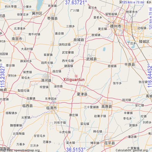
Xiliguantun GPS coordinates[2]
37° 4' 41.988" North, 115° 56' 29.004" East
| Map corner | latitude | longitude |
|---|---|---|
| Upper-left | 37.63721°, | 115.23827° |
| Center: | 37.07833°, | 115.94139° |
| Lower-right: | 36.5153°, | 116.64452° |
| Map W x H: | 124.7×124.7 km | = 77.5×77.5mi |
| max Lat: | 53.31946° ⇑20.6% North |
| Xiliguantun: | 37.07833° |
| min Lat: | ⇓79.4% South 18.22056° |
| min Long | Xiliguantun | max Long |
| 75.07348° | 115.94139° | 134.28917° |
| W 59.7%⇐ | ⇒40.3% E |
Elevation
Elevation of Xiliguantun is 28 m = 92 ft, and this is 456.8 m = 1499 ft below average elevation for this country.
| Max E: |
5622 m = 18445 ft | 79.3% |
| Avg. | 484.8 m = 1591 ft | |
| Xiliguantun | 28 m = 92 ft | |
Min E: |
-3 m = -10 ft | 20.7% |
See also: China elevation on elevation.city.
Geographical zone
Xiliguantun is located in North temperate zone (between Tropic of Cancer and the Arctic Circle). Distance of this Northern Tropic circle is 1516.8 km =942.5 mi to South.| Distance of | km | miles | from Xiliguantun |
|---|---|---|---|
| North Pole | 5884.3 | 3656.3 | to North |
| Arctic Circle | 3278.5 | 2037.2 | to North |
| Tropic Cancer | 1516.8 | 942.5 | to South |
| Equator | 4122.7 | 2561.7 | to South |


Nearby cities:
15 places around Xiliguantun: (largest is in red/bold)
• Dezhou
52.8 km =32.8 mi,  38°
38°
• Dongluqiao
69.3 km =43.1 mi,  230°
230°
• Gaobeijie
33.6 km =20.9 mi,  223°
223°
• Jiamaying
14.4 km =8.9 mi,  3°
3°
• Laocheng
8.6 km =5.3 mi,  326°
326°
• Liaocheng
69.3 km =43.1 mi,  177°
177°
• Lingcheng
62.3 km =38.7 mi,  63°
63°
• Liuzhuang
17 km =10.6 mi,  241°
241°
• Mingzhou
61.8 km =38.4 mi,  259°
259°
• Nancheng
15.3 km =9.5 mi,  160°
160°
• Nangong
59.1 km =36.7 mi,  301°
301°
• Qiangezhai
51.6 km =32.1 mi, 255°
• Qingnian
33.4 km =20.8 mi, 217°
• Xinhu
51.6 km =32.1 mi, 37°
• Youfang
17 km =10.6 mi, 243°
Sources, notices
• [Note1] Compared only with cities in China existing in our database
• [Src1] Map data: © OpenStreetMap contributors (CC-BY-SA)
• [Src2] Other city data from geonames.org with taken over terms of usage.
• [Src3] Geographical zone / Annual Mean Temperature by Robert A. Rohde @ Wikipedia
