Weizhou geodata
Weizhou (Sichuan) is a seat of a third-order administrative division; located in China in Asia/Shanghai (GMT+8) time zone. In our database, there are 1268 cities with bigger population. Compared to other cities in China, 58.4% of cities are located further ↓South; 90.8% of cities are located further →East and 92.3% of cities have lower elevation than Weizhou. Note1


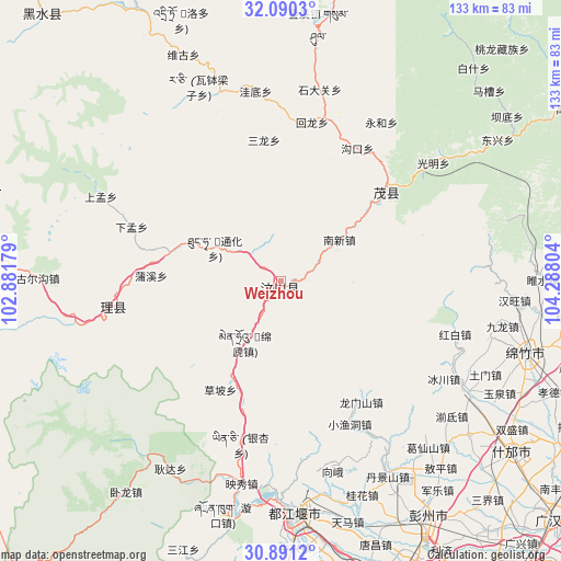
Weizhou GPS coordinates[2]
31° 29' 33.612" North, 103° 35' 5.676" East
| Map corner | latitude | longitude |
|---|---|---|
| Upper-left | 32.0903°, | 102.88179° |
| Center: | 31.49267°, | 103.58491° |
| Lower-right: | 30.8912°, | 104.28804° |
| Map W x H: | 133.3×133.3 km | = 82.8×82.8mi |
| max Lat: | 53.31946° ⇑41.6% North |
| Weizhou: | 31.49267° |
| min Lat: | ⇓58.4% South 18.22056° |
| min Long | Weizhou | max Long |
| 75.07348° | 103.58491° | 134.28917° |
| W 9.2%⇐ | ⇒90.8% E |
Elevation
Elevation of Weizhou is 1619 m = 5312 ft, and this is 1134.2 m = 3721 ft above average elevation for this country.
| Max E: |
5622 m = 18445 ft | 7.7% |
| Weizhou | 1619 m 5312 ft | |
| Avg. | 484.8 m = 1591 ft | |
Min E: |
-3 m = -10 ft | 92.3% |
See also: China elevation on elevation.city.
Geographical zone
Weizhou is located in North temperate zone (between Tropic of Cancer and the Arctic Circle). Distance of this Northern Tropic circle is 895.7 km =556.6 mi to South.| Distance of | km | miles | from Weizhou |
|---|---|---|---|
| North Pole | 6505.4 | 4042.3 | to North |
| Arctic Circle | 3899.5 | 2423 | to North |
| Tropic Cancer | 895.7 | 556.6 | to South |
| Equator | 3501.7 | 2175.9 | to South |


Nearby cities:
15 places around Weizhou: (largest is in red/bold)
• Deyang
85.8 km =53.3 mi,  118°
118°
• Fangting
68.6 km =42.6 mi,  126°
126°
• Fengyi
33.2 km =20.6 mi,  50°
50°
• Guangsheng
84.4 km =52.4 mi,  174°
174°
• Jiannan
60.3 km =37.5 mi,  105°
105°
• Luhua
85.2 km =52.9 mi,  318°
318°
• Luocheng
87.3 km =54.2 mi, 130°
• Luojiang
89.8 km =55.8 mi,  103°
103°
• Pitong
81 km =50.3 mi,  159°
159°
• Se’ergu
52 km =32.3 mi,  342°
342°
• Tianpeng
65.6 km =40.8 mi,  149°
149°
• Xipu
89.6 km =55.7 mi, 155°
• Yongchang
83 km =51.6 mi,  76°
76°
• Zagunao
39.1 km =24.3 mi,  262°
262°
• Zitong
83.2 km =51.7 mi, 172°
Sources, notices
• [Note1] Compared only with cities in China existing in our database
• [Src1] Map data: © OpenStreetMap contributors (CC-BY-SA)
• [Src2] Other city data from geonames.org with taken over terms of usage.
• [Src3] Geographical zone / Annual Mean Temperature by Robert A. Rohde @ Wikipedia
