Taozhuang geodata
Taozhuang (Shandong) is a populated place; located in China in Asia/Shanghai (GMT+8) time zone. With population of 60,137 people, there are 731 cities with bigger population in this country. Compared to other cities in China, 74.5% of cities are located further ↓South; 68% of cities are located further ←West and 69.7% of cities have higher elevation than Taozhuang. Note1


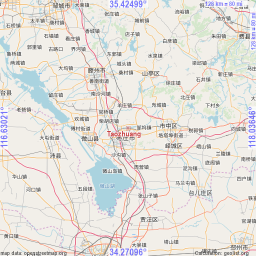
Taozhuang GPS coordinates[2]
34° 51' 0" North, 117° 19' 59.988" East
| Map corner | latitude | longitude |
|---|---|---|
| Upper-left | 35.42499°, | 116.63021° |
| Center: | 34.85°, | 117.33333° |
| Lower-right: | 34.27096°, | 118.03646° |
| Map W x H: | 128.3×128.3 km | = 79.7×79.7mi |
| max Lat: | 53.31946° ⇑25.5% North |
| Taozhuang: | 34.85° |
| min Lat: | ⇓74.5% South 18.22056° |
| min Long | Taozhuang | max Long |
| 75.07348° | 117.33333° | 134.28917° |
| W 68%⇐ | ⇒32% E |
Elevation
Elevation of Taozhuang is 53 m = 174 ft, and this is 431.8 m = 1417 ft below average elevation for this country.
| Max E: |
5622 m = 18445 ft | 69.7% |
| Avg. | 484.8 m = 1591 ft | |
| Taozhuang | 53 m = 174 ft | |
Min E: |
-3 m = -10 ft | 30.3% |
See also: Taozhuang elevation on elevation.city.
Geographical zone
Taozhuang is located in North temperate zone (between Tropic of Cancer and the Arctic Circle). Distance of this Northern Tropic circle is 1269 km =788.5 mi to South.| Distance of | km | miles | from Taozhuang |
|---|---|---|---|
| North Pole | 6132.1 | 3810.3 | to North |
| Arctic Circle | 3526.2 | 2191.1 | to North |
| Tropic Cancer | 1269 | 788.5 | to South |
| Equator | 3875 | 2407.8 | to South |


Nearby cities:
15 places around Taozhuang: (largest is in red/bold)
• Bianzhuang
64.9 km =40.3 mi,  90°
90°
• Chengtangcun
29 km =18 mi,  333°
333°
• Feicheng
73.6 km =45.7 mi,  51°
51°
• Fengxian
70.1 km =43.6 mi,  256°
256°
• Jiuli
64.4 km =40 mi,  196°
196°
• Longcheng
81.9 km =50.9 mi,  205°
205°
• Peicheng
39.4 km =24.5 mi,  251°
251°
• Pingyi
77.2 km =48 mi,  20°
20°
• Shanting
27.5 km =17.1 mi, 24°
• Tongshan
76.2 km =47.3 mi,  192°
192°
• Xiazhen
20.9 km =13 mi, 255°
• Xuzhou
71.9 km =44.7 mi,  183°
183°
• Yucheng
79.7 km =49.5 mi,  276°
276°
• Zaozhuang
20.2 km =12.6 mi, 85°
• Zoucheng
69.8 km =43.4 mi, 331°
Sources, notices
• [Note1] Compared only with cities in China existing in our database
• [Src1] Map data: © OpenStreetMap contributors (CC-BY-SA)
• [Src2] Other city data from geonames.org with taken over terms of usage.
• [Src3] Geographical zone / Annual Mean Temperature by Robert A. Rohde @ Wikipedia
