Zaozhuang geodata
Zaozhuang (Shandong) is a populated place; located in China in Asia/Shanghai (GMT+8) time zone. With population of 183,665 people, there are 246 cities with bigger population in this country. Compared to other cities in China, 74.5% of cities are located further ↓South; 69% of cities are located further ←West and 63.7% of cities have higher elevation than Zaozhuang. Note1


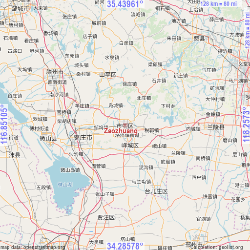
Zaozhuang GPS coordinates[2]
34° 51' 52.992" North, 117° 33' 15.012" East
| Map corner | latitude | longitude |
|---|---|---|
| Upper-left | 35.43961°, | 116.85105° |
| Center: | 34.86472°, | 117.55417° |
| Lower-right: | 34.28578°, | 118.2573° |
| Map W x H: | 128.3×128.3 km | = 79.7×79.7mi |
| max Lat: | 53.31946° ⇑25.5% North |
| Zaozhuang: | 34.86472° |
| min Lat: | ⇓74.5% South 18.22056° |
| min Long | Zaozhuang | max Long |
| 75.07348° | 117.55417° | 134.28917° |
| W 69%⇐ | ⇒31% E |
Elevation
Elevation of Zaozhuang is 79 m = 259 ft, and this is 405.8 m = 1331 ft below average elevation for this country.
| Max E: |
5622 m = 18445 ft | 63.7% |
| Avg. | 484.8 m = 1591 ft | |
| Zaozhuang | 79 m = 259 ft | |
Min E: |
-3 m = -10 ft | 36.3% |
See also: Zaozhuang elevation on elevation.city.
Geographical zone
Zaozhuang is located in North temperate zone (between Tropic of Cancer and the Arctic Circle). Distance of this Northern Tropic circle is 1270.7 km =789.6 mi to South.| Distance of | km | miles | from Zaozhuang |
|---|---|---|---|
| North Pole | 6130.5 | 3809.3 | to North |
| Arctic Circle | 3524.6 | 2190.1 | to North |
| Tropic Cancer | 1270.7 | 789.6 | to South |
| Equator | 3876.6 | 2408.8 | to South |


Nearby cities:
15 places around Zaozhuang: (largest is in red/bold)
• Bianzhuang
44.8 km =27.8 mi,  92°
92°
• Chengtangcun
41.1 km =25.5 mi,  306°
306°
• Feicheng
57.9 km =36 mi,  40°
40°
• Jiuli
74.1 km =46 mi,  211°
211°
• Linyi
75.2 km =46.7 mi,  72°
72°
• Peicheng
59.2 km =36.8 mi,  256°
256°
• Pingyi
71 km =44.1 mi,  5°
5°
• Pizhou
71.4 km =44.4 mi,  149°
149°
• Shanting
25 km =15.5 mi,  339°
339°
• Tancheng
76.8 km =47.7 mi,  111°
111°
• Taozhuang
20.2 km =12.6 mi,  265°
265°
• Tongshan
84.3 km =52.4 mi, 205°
• Xiazhen
41 km =25.5 mi, 260°
• Xuzhou
77.5 km =48.2 mi,  198°
198°
• Zoucheng
80.1 km =49.8 mi,  318°
318°
Sources, notices
• [Note1] Compared only with cities in China existing in our database
• [Src1] Map data: © OpenStreetMap contributors (CC-BY-SA)
• [Src2] Other city data from geonames.org with taken over terms of usage.
• [Src3] Geographical zone / Annual Mean Temperature by Robert A. Rohde @ Wikipedia
