Taiping geodata
Taiping (Hubei) is a seat of a fourth-order administrative division; located in China in Asia/Shanghai (GMT+8) time zone. In our database, there are 1268 cities with bigger population. Compared to other cities in China, 56% of cities are located further ↑North; 71.7% of cities are located further →East and 84.2% of cities have lower elevation than Taiping. Note1


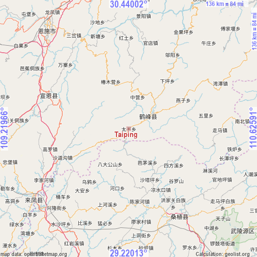
Taiping GPS coordinates[2]
29° 49' 54.984" North, 109° 55' 22.008" East
| Map corner | latitude | longitude |
|---|---|---|
| Upper-left | 30.44002°, | 109.21966° |
| Center: | 29.83194°, | 109.92278° |
| Lower-right: | 29.22013°, | 110.62591° |
| Map W x H: | 135.6×135.6 km | = 84.3×84.3mi |
| max Lat: | 53.31946° ⇑56% North |
| Taiping: | 29.83194° |
| min Lat: | ⇓44% South 18.22056° |
| min Long | Taiping | max Long |
| 75.07348° | 109.92278° | 134.28917° |
| W 28.3%⇐ | ⇒71.7% E |
Elevation
Elevation of Taiping is 930 m = 3051 ft, and this is 445.2 m = 1461 ft above average elevation for this country.
| Max E: |
5622 m = 18445 ft | 15.8% |
| Taiping | 930 m 3051 ft | |
| Avg. | 484.8 m = 1591 ft | |
Min E: |
-3 m = -10 ft | 84.2% |
See also: China elevation on elevation.city.
Geographical zone
Taiping is located in North temperate zone (between Tropic of Cancer and the Arctic Circle). Distance of this Northern Tropic circle is 711.1 km =441.9 mi to South.| Distance of | km | miles | from Taiping |
|---|---|---|---|
| North Pole | 6690.1 | 4157 | to North |
| Arctic Circle | 4084.2 | 2537.8 | to North |
| Tropic Cancer | 711.1 | 441.9 | to South |
| Equator | 3317 | 2061.1 | to South |


Nearby cities:
15 places around Taiping: (largest is in red/bold)
• Bamaoxi
20.2 km =12.6 mi,  150°
150°
• Chunmuying
26.7 km =16.6 mi,  339°
339°
• Jianjiapo
31.2 km =19.4 mi,  174°
174°
• Kuzhuping
25.8 km =16 mi,  142°
142°
• Liangshuikou
36.4 km =22.6 mi, 152°
• Longtanping
28.4 km =17.6 mi,  127°
127°
• Pailou
32 km =19.9 mi,  191°
191°
• Rongmei
12.1 km =7.5 mi,  55°
55°
• Shadiping
21 km =13 mi,  207°
207°
• Shataping
29.3 km =18.2 mi,  157°
157°
• Sifangxi
30.5 km =19 mi, 128°
• Wangjiaping
14.3 km =8.9 mi,  183°
183°
• Wuyahe
34.9 km =21.7 mi,  215°
215°
• Yanzi
32.4 km =20.1 mi, 62°
• Zhongying
17.4 km =10.8 mi,  15°
15°
Sources, notices
• [Note1] Compared only with cities in China existing in our database
• [Src1] Map data: © OpenStreetMap contributors (CC-BY-SA)
• [Src2] Other city data from geonames.org with taken over terms of usage.
• [Src3] Geographical zone / Annual Mean Temperature by Robert A. Rohde @ Wikipedia
