Taihe geodata
Taihe (Sichuan) is a seat of a third-order administrative division; located in China in Asia/Shanghai (GMT+8) time zone. In our database, there are 1268 cities with bigger population. Compared to other cities in China, 53.6% of cities are located further ↓South; 88.4% of cities are located further →East and 65.6% of cities have lower elevation than Taihe. Note1


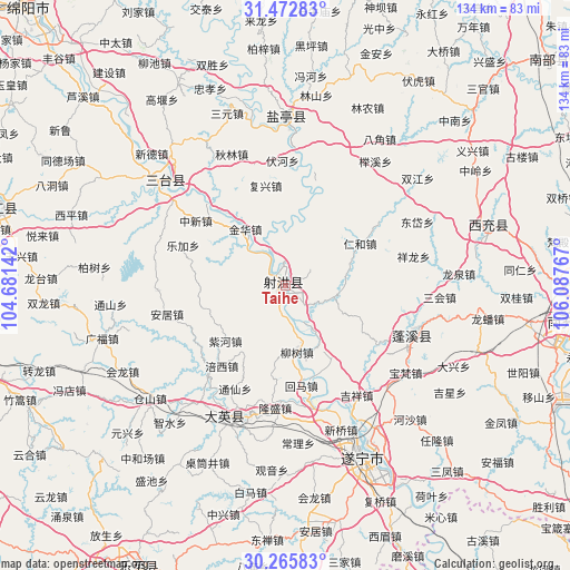
Taihe GPS coordinates[2]
30° 52' 16.428" North, 105° 23' 4.344" East
| Map corner | latitude | longitude |
|---|---|---|
| Upper-left | 31.47283°, | 104.68142° |
| Center: | 30.87123°, | 105.38454° |
| Lower-right: | 30.26583°, | 106.08767° |
| Map W x H: | 134.2×134.2 km | = 83.4×83.4mi |
| max Lat: | 53.31946° ⇑46.4% North |
| Taihe: | 30.87123° |
| min Lat: | ⇓53.6% South 18.22056° |
| min Long | Taihe | max Long |
| 75.07348° | 105.38454° | 134.28917° |
| W 11.6%⇐ | ⇒88.4% E |
Elevation
Elevation of Taihe is 337 m = 1106 ft, and this is 147.8 m = 485 ft below average elevation for this country.
| Max E: |
5622 m = 18445 ft | 34.4% |
| Avg. | 484.8 m = 1591 ft | |
| Taihe | 337 m = 1106 ft | |
Min E: |
-3 m = -10 ft | 65.6% |
See also: China elevation on elevation.city.
Geographical zone
Taihe is located in North temperate zone (between Tropic of Cancer and the Arctic Circle). Distance of this Northern Tropic circle is 826.6 km =513.6 mi to South.| Distance of | km | miles | from Taihe |
|---|---|---|---|
| North Pole | 6574.5 | 4085.2 | to North |
| Arctic Circle | 3968.6 | 2466 | to North |
| Tropic Cancer | 826.6 | 513.6 | to South |
| Equator | 3432.6 | 2132.9 | to South |


Nearby cities:
15 places around Taihe: (largest is in red/bold)
• Anju
58.4 km =36.3 mi,  173°
173°
• Chicheng
32.9 km =20.4 mi,  108°
108°
• Gaoping
69.4 km =43.1 mi,  98°
98°
• Huayan
72.6 km =45.1 mi,  160°
160°
• Huohua
65.6 km =40.8 mi, 100°
• Jincheng
49.5 km =30.8 mi,  73°
73°
• Kaijiang
70.2 km =43.6 mi,  285°
285°
• Mixin
65.8 km =40.9 mi,  146°
146°
• Nanchong
67.4 km =41.9 mi, 97°
• Penglai
34.6 km =21.5 mi,  201°
201°
• Suining
44.2 km =27.5 mi, 155°
• Tianchi
74.2 km =46.1 mi,  207°
207°
• Tongchuan
37.6 km =23.4 mi,  311°
311°
• Yunxi
39.5 km =24.5 mi,  0°
0°
• Yuxi
71.5 km =44.4 mi, 148°
Sources, notices
• [Note1] Compared only with cities in China existing in our database
• [Src1] Map data: © OpenStreetMap contributors (CC-BY-SA)
• [Src2] Other city data from geonames.org with taken over terms of usage.
• [Src3] Geographical zone / Annual Mean Temperature by Robert A. Rohde @ Wikipedia
