Chicheng geodata
Chicheng (Sichuan) is a seat of a third-order administrative division; located in China in Asia/Shanghai (GMT+8) time zone. In our database, there are 1268 cities with bigger population. Compared to other cities in China, 52.8% of cities are located further ↓South; 87.8% of cities are located further →East and 66.2% of cities have lower elevation than Chicheng. Note1


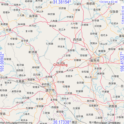
Chicheng GPS coordinates[2]
30° 46' 45.696" North, 105° 42' 43.704" East
| Map corner | latitude | longitude |
|---|---|---|
| Upper-left | 31.38154°, | 105.00902° |
| Center: | 30.77936°, | 105.71214° |
| Lower-right: | 30.17338°, | 106.41527° |
| Map W x H: | 134.3×134.3 km | = 83.5×83.5mi |
| max Lat: | 53.31946° ⇑47.2% North |
| Chicheng: | 30.77936° |
| min Lat: | ⇓52.8% South 18.22056° |
| min Long | Chicheng | max Long |
| 75.07348° | 105.71214° | 134.28917° |
| W 12.2%⇐ | ⇒87.8% E |
Elevation
Elevation of Chicheng is 347 m = 1138 ft, and this is 137.8 m = 452 ft below average elevation for this country.
| Max E: |
5622 m = 18445 ft | 33.8% |
| Avg. | 484.8 m = 1591 ft | |
| Chicheng | 347 m = 1138 ft | |
Min E: |
-3 m = -10 ft | 66.2% |
See also: China elevation on elevation.city.
Geographical zone
Chicheng is located in North temperate zone (between Tropic of Cancer and the Arctic Circle). Distance of this Northern Tropic circle is 816.4 km =507.3 mi to South.| Distance of | km | miles | from Chicheng |
|---|---|---|---|
| North Pole | 6584.7 | 4091.5 | to North |
| Arctic Circle | 3978.8 | 2472.3 | to North |
| Tropic Cancer | 816.4 | 507.3 | to South |
| Equator | 3422.3 | 2126.5 | to South |


Nearby cities:
15 places around Chicheng: (largest is in red/bold)
• Anju
53.7 km =33.4 mi,  207°
207°
• Baolong
51.2 km =31.8 mi,  157°
157°
• Erlang
53.5 km =33.2 mi,  149°
149°
• Gaoping
37.3 km =23.2 mi,  90°
90°
• Guxi
52.2 km =32.4 mi, 162°
• Huayan
58.5 km =36.4 mi,  186°
186°
• Huohua
33.2 km =20.6 mi, 93°
• Jincheng
29.1 km =18.1 mi,  33°
33°
• Mixin
44.7 km =27.8 mi,  173°
173°
• Nanchong
35.6 km =22.1 mi, 87°
• Penglai
49.2 km =30.6 mi,  243°
243°
• Qunli
54.5 km =33.9 mi, 167°
• Suining
33 km =20.5 mi,  203°
203°
• Taihe
32.9 km =20.4 mi,  288°
288°
• Yuxi
51 km =31.7 mi, 172°
Sources, notices
• [Note1] Compared only with cities in China existing in our database
• [Src1] Map data: © OpenStreetMap contributors (CC-BY-SA)
• [Src2] Other city data from geonames.org with taken over terms of usage.
• [Src3] Geographical zone / Annual Mean Temperature by Robert A. Rohde @ Wikipedia
