Shuangjiang geodata
Shuangjiang (Hunan) is a seat of a third-order administrative division; located in China in Asia/Shanghai (GMT+8) time zone. With population of 8,320 people, there are 825 cities with bigger population in this country. Compared to other cities in China, 81.7% of cities are located further ↑North; 72.7% of cities are located further →East and 75.1% of cities have lower elevation than Shuangjiang. Note1


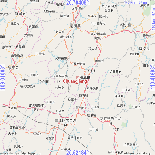
Shuangjiang GPS coordinates[2]
26° 9' 16.812" North, 109° 42' 49.68" East
| Map corner | latitude | longitude |
|---|---|---|
| Upper-left | 26.78408°, | 109.01068° |
| Center: | 26.15467°, | 109.7138° |
| Lower-right: | 25.52184°, | 110.41693° |
| Map W x H: | 140.3×140.3 km | = 87.2×87.2mi |
| max Lat: | 53.31946° ⇑81.7% North |
| Shuangjiang: | 26.15467° |
| min Lat: | ⇓18.3% South 18.22056° |
| min Long | Shuangjiang | max Long |
| 75.07348° | 109.7138° | 134.28917° |
| W 27.3%⇐ | ⇒72.7% E |
Elevation
Elevation of Shuangjiang is 525 m = 1722 ft, and this is 40.2 m = 132 ft above average elevation for this country.
| Max E: |
5622 m = 18445 ft | 24.9% |
| Shuangjiang | 525 m 1722 ft | |
| Avg. | 484.8 m = 1591 ft | |
Min E: |
-3 m = -10 ft | 75.1% |
See also: China elevation on elevation.city.
Geographical zone
Shuangjiang is located in North temperate zone (between Tropic of Cancer and the Arctic Circle). Distance of this Northern Tropic circle is 302.2 km =187.8 mi to South.| Distance of | km | miles | from Shuangjiang |
|---|---|---|---|
| North Pole | 7098.9 | 4411.1 | to North |
| Arctic Circle | 4493 | 2791.8 | to North |
| Tropic Cancer | 302.2 | 187.8 | to South |
| Equator | 2908.1 | 1807 | to South |


Nearby cities:
15 places around Shuangjiang: (largest is in red/bold)
• Boyang
20.3 km =12.6 mi,  288°
288°
• Chang’anying
39.4 km =24.5 mi,  72°
72°
• Diyangping
17.1 km =10.6 mi,  320°
320°
• Guyi
43.4 km =27 mi,  195°
195°
• Hongzhou
30.6 km =19 mi,  263°
263°
• Jiangtousi
45.8 km =28.5 mi,  93°
93°
• Le’anpu Miaozudongzuxiang
42.2 km =26.2 mi,  26°
26°
• Linkou
18.2 km =11.3 mi,  55°
55°
• Longcheng
14.8 km =9.2 mi,  154°
154°
• Longsheng
49.8 km =30.9 mi,  143°
143°
• Pukou
43.8 km =27.2 mi,  338°
338°
• Quyang
47.3 km =29.4 mi,  350°
350°
• Xianxi
21.2 km =13.2 mi, 340°
• Yatunpu
8.7 km =5.4 mi,  270°
270°
• Zhongchao
49.3 km =30.6 mi, 267°
In other languages:
- In Chinese: T’ung-tao-t’ung-tsu-tzu-chih-hsien, T’ung-tao, Shuang-chiang-k’ou, 双江
Sources, notices
• [Note1] Compared only with cities in China existing in our database
• [Src1] Map data: © OpenStreetMap contributors (CC-BY-SA)
• [Src2] Other city data from geonames.org with taken over terms of usage.
• [Src3] Geographical zone / Annual Mean Temperature by Robert A. Rohde @ Wikipedia
