Rucheng Chengguanzhen geodata
Rucheng Chengguanzhen (Hunan) is a seat of a third-order administrative division; located in China in Asia/Shanghai (GMT+8) time zone. In our database, there are 1268 cities with bigger population. Compared to other cities in China, 84.1% of cities are located further ↑North; 53% of cities are located further →East and 79.5% of cities have lower elevation than Rucheng Chengguanzhen. Note1


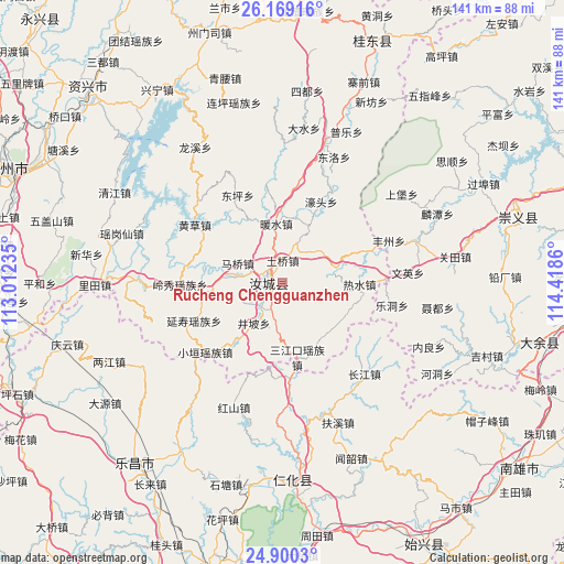
Rucheng Chengguanzhen GPS coordinates[2]
25° 32' 11.076" North, 113° 42' 55.692" East
| Map corner | latitude | longitude |
|---|---|---|
| Upper-left | 26.16916°, | 113.01235° |
| Center: | 25.53641°, | 113.71547° |
| Lower-right: | 24.9003°, | 114.4186° |
| Map W x H: | 141.1×141.1 km | = 87.7×87.7mi |
| max Lat: | 53.31946° ⇑84.1% North |
| Rucheng Chengguanzhen: | 25.53641° |
| min Lat: | ⇓15.9% South 18.22056° |
| min Long | Rucheng Chenggu | max Long |
| 75.07348° | 113.71547° | 134.28917° |
| W 47%⇐ | ⇒53% E |
Elevation
Elevation of Rucheng Chengguanzhen is 672 m = 2205 ft, and this is 187.2 m = 614 ft above average elevation for this country.
| Max E: |
5622 m = 18445 ft | 20.5% |
| Rucheng Chengguanzhen | 672 m 2205 ft | |
| Avg. | 484.8 m = 1591 ft | |
Min E: |
-3 m = -10 ft | 79.5% |
See also: China elevation on elevation.city.
Geographical zone
Rucheng Chengguanzhen is located in North temperate zone (between Tropic of Cancer and the Arctic Circle). Distance of this Northern Tropic circle is 233.5 km =145.1 mi to South.| Distance of | km | miles | from Rucheng Chengguanzhen |
|---|---|---|---|
| North Pole | 7167.7 | 4453.8 | to North |
| Arctic Circle | 4561.8 | 2834.6 | to North |
| Tropic Cancer | 233.5 | 145.1 | to South |
| Equator | 2839.4 | 1764.3 | to South |


Nearby cities:
15 places around Rucheng Chengguanzhen: (largest is in red/bold)
• Baishi
47.5 km =29.5 mi,  258°
258°
• Baishun
49.6 km =30.8 mi,  140°
140°
• Beixiang
52.2 km =32.4 mi,  223°
223°
• Changjiang
31.5 km =19.6 mi, 137°
• Chengkou
24 km =14.9 mi,  174°
174°
• Dayuan
52 km =32.3 mi,  235°
235°
• Dongtang
51.4 km =31.9 mi,  189°
189°
• Fuxi
38.2 km =23.7 mi,  158°
158°
• Hongshan
33.6 km =20.9 mi,  201°
201°
• Jiufeng
40.7 km =25.3 mi, 239°
• Langtian
49.9 km =31 mi,  211°
211°
• Liangjiang
45.5 km =28.3 mi,  246°
246°
• Renhua
49.6 km =30.8 mi,  176°
176°
• Wenshao
47.2 km =29.3 mi, 158°
• Wushan
39.6 km =24.6 mi, 216°
Sources, notices
• [Note1] Compared only with cities in China existing in our database
• [Src1] Map data: © OpenStreetMap contributors (CC-BY-SA)
• [Src2] Other city data from geonames.org with taken over terms of usage.
• [Src3] Geographical zone / Annual Mean Temperature by Robert A. Rohde @ Wikipedia
