Qinglang geodata
Qinglang (Guizhou) is a populated place; located in China in Asia/Shanghai (GMT+8) time zone. With population of 2,895 people, there are 957 cities with bigger population in this country. Compared to other cities in China, 78.1% of cities are located further ↑North; 77.5% of cities are located further →East and 69.3% of cities have lower elevation than Qinglang. Note1


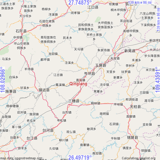
Qinglang GPS coordinates[2]
27° 7' 28.992" North, 108° 43' 58.008" East
| Map corner | latitude | longitude |
|---|---|---|
| Upper-left | 27.74875°, | 108.02966° |
| Center: | 27.12472°, | 108.73278° |
| Lower-right: | 26.49719°, | 109.43591° |
| Map W x H: | 139.2×139.2 km | = 86.5×86.5mi |
| max Lat: | 53.31946° ⇑78.1% North |
| Qinglang: | 27.12472° |
| min Lat: | ⇓21.9% South 18.22056° |
| min Long | Qinglang | max Long |
| 75.07348° | 108.73278° | 134.28917° |
| W 22.5%⇐ | ⇒77.5% E |
Elevation
Elevation of Qinglang is 398 m = 1306 ft, and this is 86.8 m = 285 ft below average elevation for this country.
| Max E: |
5622 m = 18445 ft | 30.7% |
| Avg. | 484.8 m = 1591 ft | |
| Qinglang | 398 m = 1306 ft | |
Min E: |
-3 m = -10 ft | 69.3% |
See also: China elevation on elevation.city.
Geographical zone
Qinglang is located in North temperate zone (between Tropic of Cancer and the Arctic Circle). Distance of this Northern Tropic circle is 410.1 km =254.8 mi to South.| Distance of | km | miles | from Qinglang |
|---|---|---|---|
| North Pole | 6991.1 | 4344.1 | to North |
| Arctic Circle | 4385.2 | 2724.8 | to North |
| Tropic Cancer | 410.1 | 254.8 | to South |
| Equator | 3016 | 1874.1 | to South |


Nearby cities:
15 places around Qinglang: (largest is in red/bold)
• Bangdong
47.8 km =29.7 mi,  110°
110°
• Duping
35.1 km =21.8 mi,  300°
300°
• Gongxi
42.5 km =26.4 mi,  91°
91°
• Jiaoxi
18.1 km =11.2 mi,  256°
256°
• Liangsan
22.9 km =14.2 mi,  99°
99°
• Minhe
46.3 km =28.8 mi,  5°
5°
• Runsong
45.9 km =28.5 mi,  128°
128°
• Siyang
9.7 km =6 mi, 7°
• Xinhuang
48.3 km =30 mi,  55°
55°
• Xuedong
17.5 km =10.9 mi,  136°
136°
• Yangliugou
37.9 km =23.5 mi, 9°
• Yangping
7.1 km =4.4 mi,  65°
65°
• Yongxi
41.7 km =25.9 mi,  252°
252°
• Zhongzhai
53.6 km =33.3 mi,  81°
81°
• Zhujiachang
32.9 km =20.4 mi,  38°
38°
Sources, notices
• [Note1] Compared only with cities in China existing in our database
• [Src1] Map data: © OpenStreetMap contributors (CC-BY-SA)
• [Src2] Other city data from geonames.org with taken over terms of usage.
• [Src3] Geographical zone / Annual Mean Temperature by Robert A. Rohde @ Wikipedia
