Zhujiachang geodata
Zhujiachang (Guizhou) is a populated place; located in China in Asia/Shanghai (GMT+8) time zone. With population of 1,295 people, there are 1123 cities with bigger population in this country. Compared to other cities in China, 77.2% of cities are located further ↑North; 76.5% of cities are located further →East and 74.4% of cities have lower elevation than Zhujiachang. Note1


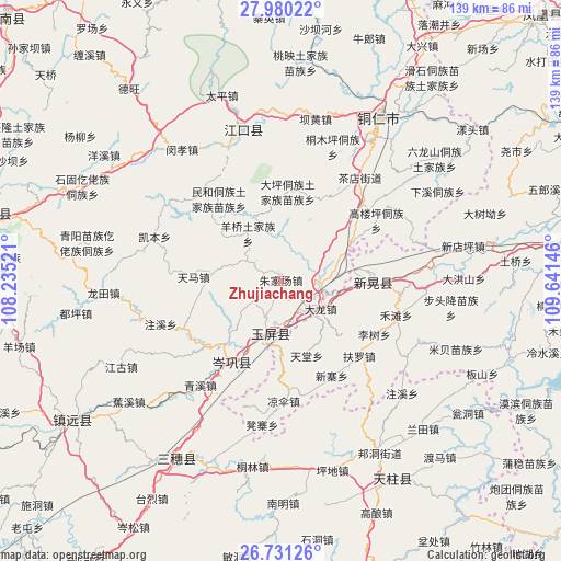
Zhujiachang GPS coordinates[2]
27° 21' 27" North, 108° 56' 17.988" East
| Map corner | latitude | longitude |
|---|---|---|
| Upper-left | 27.98022°, | 108.23521° |
| Center: | 27.3575°, | 108.93833° |
| Lower-right: | 26.73126°, | 109.64146° |
| Map W x H: | 138.9×138.9 km | = 86.3×86.3mi |
| max Lat: | 53.31946° ⇑77.2% North |
| Zhujiachang: | 27.3575° |
| min Lat: | ⇓22.8% South 18.22056° |
| min Long | Zhujiachang | max Long |
| 75.07348° | 108.93833° | 134.28917° |
| W 23.5%⇐ | ⇒76.5% E |
Elevation
Elevation of Zhujiachang is 508 m = 1667 ft, and this is 23.2 m = 76 ft above average elevation for this country.
| Max E: |
5622 m = 18445 ft | 25.6% |
| Zhujiachang | 508 m 1667 ft | |
| Avg. | 484.8 m = 1591 ft | |
Min E: |
-3 m = -10 ft | 74.4% |
See also: China elevation on elevation.city.
Geographical zone
Zhujiachang is located in North temperate zone (between Tropic of Cancer and the Arctic Circle). Distance of this Northern Tropic circle is 435.9 km =270.9 mi to South.| Distance of | km | miles | from Zhujiachang |
|---|---|---|---|
| North Pole | 6965.2 | 4328 | to North |
| Arctic Circle | 4359.3 | 2708.7 | to North |
| Tropic Cancer | 435.9 | 270.9 | to South |
| Equator | 3041.9 | 1890.1 | to South |


Nearby cities:
15 places around Zhujiachang: (largest is in red/bold)
• Bapan
39.4 km =24.5 mi,  0°
0°
• Bozhou
33.6 km =20.9 mi,  85°
85°
• Chadian
31.5 km =19.6 mi,  37°
37°
• Gongxi
35 km =21.7 mi,  140°
140°
• Liangsan
29.6 km =18.4 mi,  175°
175°
• Minhe
25.9 km =16.1 mi,  321°
321°
• Qinglang
32.9 km =20.4 mi,  218°
218°
• Siyang
25.1 km =15.6 mi,  229°
229°
• Wanshan
32.2 km =20 mi,  55°
55°
• Xinhuang
19.4 km =12.1 mi,  84°
84°
• Xuedong
39.5 km =24.5 mi,  192°
192°
• Yangliugou
18.3 km =11.4 mi,  309°
309°
• Yangping
26.8 km =16.7 mi,  211°
211°
• Youyupu
29 km =18 mi, 41°
• Zhongzhai
37.3 km =23.2 mi,  118°
118°
Sources, notices
• [Note1] Compared only with cities in China existing in our database
• [Src1] Map data: © OpenStreetMap contributors (CC-BY-SA)
• [Src2] Other city data from geonames.org with taken over terms of usage.
• [Src3] Geographical zone / Annual Mean Temperature by Robert A. Rohde @ Wikipedia
