Lucheng geodata
Lucheng (Anhui) is a seat of a third-order administrative division; located in China in Asia/Shanghai (GMT+8) time zone. With population of 89,119 people, there are 479 cities with bigger population in this country. Compared to other cities in China, 56.5% of cities are located further ↓South; 67.7% of cities are located further ←West and 85.5% of cities have higher elevation than Lucheng. Note1


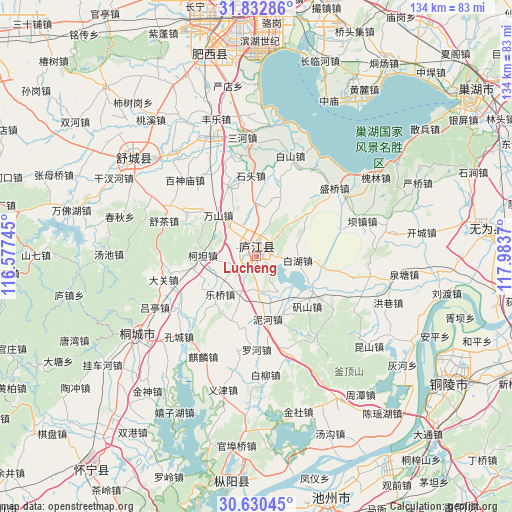
Lucheng GPS coordinates[2]
31° 14' 0.852" North, 117° 16' 50.052" East
| Map corner | latitude | longitude |
|---|---|---|
| Upper-left | 31.83286°, | 116.57745° |
| Center: | 31.23357°, | 117.28057° |
| Lower-right: | 30.63045°, | 117.9837° |
| Map W x H: | 133.7×133.7 km | = 83.1×83.1mi |
| max Lat: | 53.31946° ⇑43.5% North |
| Lucheng: | 31.23357° |
| min Lat: | ⇓56.5% South 18.22056° |
| min Long | Lucheng | max Long |
| 75.07348° | 117.28057° | 134.28917° |
| W 67.7%⇐ | ⇒32.3% E |
Elevation
Elevation of Lucheng is 15 m = 49 ft, and this is 469.8 m = 1541 ft below average elevation for this country.
| Max E: |
5622 m = 18445 ft | 85.5% |
| Avg. | 484.8 m = 1591 ft | |
| Lucheng | 15 m = 49 ft | |
Min E: |
-3 m = -10 ft | 14.5% |
See also: Lucheng elevation on elevation.city.
Geographical zone
Lucheng is located in North temperate zone (between Tropic of Cancer and the Arctic Circle). Distance of this Northern Tropic circle is 866.9 km =538.7 mi to South.| Distance of | km | miles | from Lucheng |
|---|---|---|---|
| North Pole | 6534.2 | 4060.2 | to North |
| Arctic Circle | 3928.3 | 2440.9 | to North |
| Tropic Cancer | 866.9 | 538.7 | to South |
| Equator | 3472.8 | 2157.9 | to South |


Nearby cities:
15 places around Lucheng: (largest is in red/bold)
• Chaohu
68.9 km =42.8 mi,  53°
53°
• Chizhou
66.3 km =41.2 mi,  163°
163°
• Dianbu
73.1 km =45.4 mi,  13°
13°
• Digang
70 km =43.5 mi,  99°
99°
• Dougou
71.1 km =44.2 mi,  78°
78°
• Gaohe
68.8 km =42.8 mi,  217°
217°
• Hefei
70.1 km =43.6 mi,  0°
0°
• Quedian
42.7 km =26.5 mi,  280°
280°
• Shangpai
58.1 km =36.1 mi,  348°
348°
• Shucheng Chengguanzhen
41.1 km =25.5 mi,  310°
310°
• Tongcheng
36.3 km =22.6 mi,  233°
233°
• Wucheng
59.3 km =36.8 mi, 84°
• Wusong
57.3 km =35.6 mi,  123°
123°
• Yijin
35.8 km =22.2 mi,  192°
192°
• Zongyang
59.9 km =37.2 mi, 186°
Sources, notices
• [Note1] Compared only with cities in China existing in our database
• [Src1] Map data: © OpenStreetMap contributors (CC-BY-SA)
• [Src2] Other city data from geonames.org with taken over terms of usage.
• [Src3] Geographical zone / Annual Mean Temperature by Robert A. Rohde @ Wikipedia
