Hekou geodata
Hekou (Hunan) is a populated place; located in China in Asia/Shanghai (GMT+8) time zone. With population of 930 people, there are 1191 cities with bigger population in this country. Compared to other cities in China, 79.6% of cities are located further ↑North; 71% of cities are located further →East and 63.3% of cities have lower elevation than Hekou. Note1


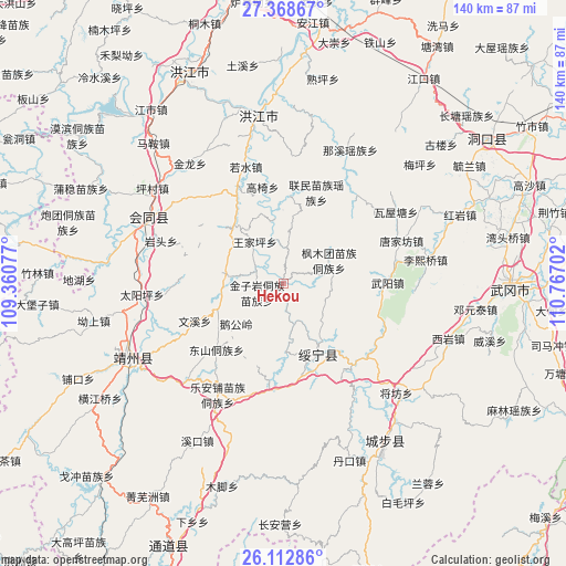
Hekou GPS coordinates[2]
26° 44' 33" North, 110° 3' 50.004" East
| Map corner | latitude | longitude |
|---|---|---|
| Upper-left | 27.36867°, | 109.36077° |
| Center: | 26.7425°, | 110.06389° |
| Lower-right: | 26.11286°, | 110.76702° |
| Map W x H: | 139.6×139.6 km | = 86.7×86.7mi |
| max Lat: | 53.31946° ⇑79.6% North |
| Hekou: | 26.7425° |
| min Lat: | ⇓20.4% South 18.22056° |
| min Long | Hekou | max Long |
| 75.07348° | 110.06389° | 134.28917° |
| W 29%⇐ | ⇒71% E |
Elevation
Elevation of Hekou is 301 m = 988 ft, and this is 183.8 m = 603 ft below average elevation for this country.
| Max E: |
5622 m = 18445 ft | 36.7% |
| Avg. | 484.8 m = 1591 ft | |
| Hekou | 301 m = 988 ft | |
Min E: |
-3 m = -10 ft | 63.3% |
See also: China elevation on elevation.city.
Geographical zone
Hekou is located in North temperate zone (between Tropic of Cancer and the Arctic Circle). Distance of this Northern Tropic circle is 367.6 km =228.4 mi to South.| Distance of | km | miles | from Hekou |
|---|---|---|---|
| North Pole | 7033.6 | 4370.5 | to North |
| Arctic Circle | 4427.7 | 2751.2 | to North |
| Tropic Cancer | 367.6 | 228.4 | to South |
| Equator | 2973.5 | 1847.6 | to South |


Nearby cities:
15 places around Hekou: (largest is in red/bold)
• Changpu
19 km =11.8 mi,  166°
166°
• Dongshan Dongzuxiang
23.3 km =14.5 mi,  225°
225°
• Gaoyi
24.6 km =15.3 mi,  348°
348°
• Guanxia Miaozuxiang
28.4 km =17.6 mi,  131°
131°
• Huangtukuang
39.2 km =24.4 mi,  60°
60°
• Jiangfang
38.8 km =24.1 mi, 133°
• Le’anpu Miaozudongzuxiang
31.9 km =19.8 mi,  210°
210°
• Lianshan
36.6 km =22.7 mi,  280°
280°
• Lixiqiao
35.6 km =22.1 mi,  80°
80°
• Puzi
39.4 km =24.5 mi,  313°
313°
• Ruoshui
30.4 km =18.9 mi,  341°
341°
• Tangjiafang
31.8 km =19.8 mi,  70°
70°
• Wuyang
26.3 km =16.3 mi,  89°
89°
• Zhaishi Miaozu Dongzuxiang
26.9 km =16.7 mi,  184°
184°
• Zhuzhoujiang Miaozuxiang
7.5 km =4.7 mi, 173°
Sources, notices
• [Note1] Compared only with cities in China existing in our database
• [Src1] Map data: © OpenStreetMap contributors (CC-BY-SA)
• [Src2] Other city data from geonames.org with taken over terms of usage.
• [Src3] Geographical zone / Annual Mean Temperature by Robert A. Rohde @ Wikipedia
