Hecun geodata
Hecun (Hebei) is a populated place; located in China in Asia/Shanghai (GMT+8) time zone. With population of 83,009 people, there are 510 cities with bigger population in this country. Compared to other cities in China, 78.3% of cities are located further ↓South; 50.7% of cities are located further →East and 59% of cities have lower elevation than Hecun. Note1


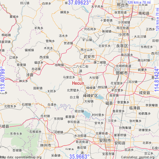
Hecun GPS coordinates[2]
36° 31' 59.988" North, 114° 6' 39.996" East
| Map corner | latitude | longitude |
|---|---|---|
| Upper-left | 37.09623°, | 113.40799° |
| Center: | 36.53333°, | 114.11111° |
| Lower-right: | 35.9663°, | 114.81424° |
| Map W x H: | 125.6×125.6 km | = 78×78mi |
| max Lat: | 53.31946° ⇑21.7% North |
| Hecun: | 36.53333° |
| min Lat: | ⇓78.3% South 18.22056° |
| min Long | Hecun | max Long |
| 75.07348° | 114.11111° | 134.28917° |
| W 49.3%⇐ | ⇒50.7% E |
Elevation
Elevation of Hecun is 247 m = 810 ft, and this is 237.8 m = 780 ft below average elevation for this country.
| Max E: |
5622 m = 18445 ft | 41% |
| Avg. | 484.8 m = 1591 ft | |
| Hecun | 247 m = 810 ft | |
Min E: |
-3 m = -10 ft | 59% |
See also: Hecun elevation on elevation.city.
Geographical zone
Hecun is located in North temperate zone (between Tropic of Cancer and the Arctic Circle). Distance of this Northern Tropic circle is 1456.2 km =904.8 mi to South.| Distance of | km | miles | from Hecun |
|---|---|---|---|
| North Pole | 5944.9 | 3694 | to North |
| Arctic Circle | 3339 | 2074.8 | to North |
| Tropic Cancer | 1456.2 | 904.8 | to South |
| Equator | 4062.1 | 2524.1 | to South |


Nearby cities:
15 places around Hecun: (largest is in red/bold)
• Anyang
54.4 km =33.8 mi,  153°
153°
• Chensan
94.1 km =58.5 mi,  76°
76°
• Handan
32.7 km =20.3 mi, 76°
• Hebi
70.9 km =44.1 mi,  174°
174°
• Kaiyuan
57.8 km =35.9 mi,  206°
206°
• Liaoyang
91.7 km =57 mi,  311°
311°
• Lihou
66.4 km =41.3 mi,  267°
267°
• Linshui
14.7 km =9.1 mi, 145°
• Luhua
82.4 km =51.2 mi,  254°
254°
• Pengcheng
12.5 km =7.8 mi,  155°
155°
• Qingyang
71.9 km =44.7 mi,  239°
239°
• Shahecheng
57.1 km =35.5 mi,  37°
37°
• Tangyang Chengguanzhen
72.2 km =44.9 mi, 162°
• Xingtai
68.1 km =42.3 mi,  30°
30°
• Yigou
82.4 km =51.2 mi, 167°
Sources, notices
• [Note1] Compared only with cities in China existing in our database
• [Src1] Map data: © OpenStreetMap contributors (CC-BY-SA)
• [Src2] Other city data from geonames.org with taken over terms of usage.
• [Src3] Geographical zone / Annual Mean Temperature by Robert A. Rohde @ Wikipedia
