Jingzhou geodata
Jingzhou (Hebei) is a seat of a third-order administrative division; located in China in Asia/Shanghai (GMT+8) time zone. In our database, there are 1268 cities with bigger population. Compared to other cities in China, 80.6% of cities are located further ↓South; 61.5% of cities are located further ←West and 82.9% of cities have higher elevation than Jingzhou. Note1


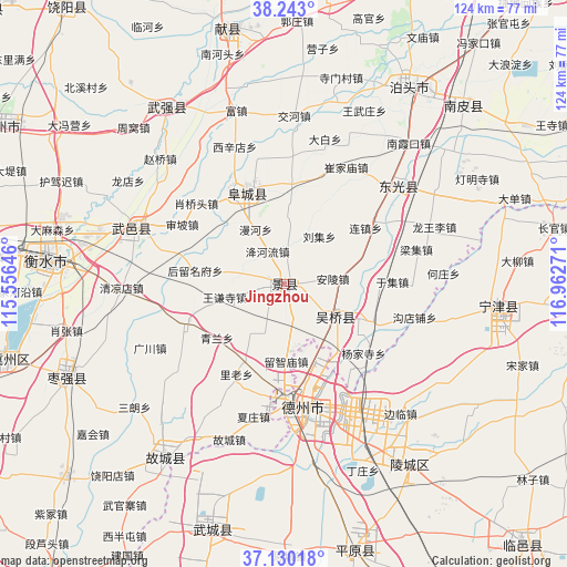
Jingzhou GPS coordinates[2]
37° 41' 19.248" North, 116° 15' 34.488" East
| Map corner | latitude | longitude |
|---|---|---|
| Upper-left | 38.243°, | 115.55646° |
| Center: | 37.68868°, | 116.25958° |
| Lower-right: | 37.13018°, | 116.96271° |
| Map W x H: | 123.7×123.7 km | = 76.9×76.9mi |
| max Lat: | 53.31946° ⇑19.4% North |
| Jingzhou: | 37.68868° |
| min Lat: | ⇓80.6% South 18.22056° |
| min Long | Jingzhou | max Long |
| 75.07348° | 116.25958° | 134.28917° |
| W 61.5%⇐ | ⇒38.5% E |
Elevation
Elevation of Jingzhou is 20 m = 66 ft, and this is 464.8 m = 1525 ft below average elevation for this country.
| Max E: |
5622 m = 18445 ft | 82.9% |
| Avg. | 484.8 m = 1591 ft | |
| Jingzhou | 20 m = 66 ft | |
Min E: |
-3 m = -10 ft | 17.1% |
See also: China elevation on elevation.city.
Geographical zone
Jingzhou is located in North temperate zone (between Tropic of Cancer and the Arctic Circle). Distance of this Northern Tropic circle is 1584.7 km =984.7 mi to South.| Distance of | km | miles | from Jingzhou |
|---|---|---|---|
| North Pole | 5816.5 | 3614.2 | to North |
| Arctic Circle | 3210.6 | 1995 | to North |
| Tropic Cancer | 1584.7 | 984.7 | to South |
| Equator | 4190.6 | 2603.9 | to South |


Nearby cities:
15 places around Jingzhou: (largest is in red/bold)
• Botou
49.9 km =31 mi,  32°
32°
• Dengmingsi
48.5 km =30.1 mi,  60°
60°
• Dezhou
26.8 km =16.7 mi,  170°
170°
• Dongguang
32.5 km =20.2 mi,  47°
47°
• Duancun
67.3 km =41.8 mi,  340°
340°
• Fucheng
22.2 km =13.8 mi,  334°
334°
• Hengshui
49.4 km =30.7 mi,  275°
275°
• Jiamaying
60 km =37.3 mi,  207°
207°
• Laocheng
69 km =42.9 mi, 208°
• Lingcheng
48.2 km =30 mi,  145°
145°
• Nanpi
54.4 km =33.8 mi, 45°
• Ningjin
47.2 km =29.3 mi,  95°
95°
• Sangyuan
12.9 km =8 mi,  122°
122°
• Xiliguantun
73.5 km =45.7 mi,  202°
202°
• Xinhu
27.1 km =16.8 mi, 172°
Sources, notices
• [Note1] Compared only with cities in China existing in our database
• [Src1] Map data: © OpenStreetMap contributors (CC-BY-SA)
• [Src2] Other city data from geonames.org with taken over terms of usage.
• [Src3] Geographical zone / Annual Mean Temperature by Robert A. Rohde @ Wikipedia
