Sangyuan geodata
Sangyuan (Hebei) is a seat of a third-order administrative division; located in China in Asia/Shanghai (GMT+8) time zone. In our database, there are 1268 cities with bigger population. Compared to other cities in China, 80.5% of cities are located further ↓South; 62.3% of cities are located further ←West and 83.4% of cities have higher elevation than Sangyuan. Note1


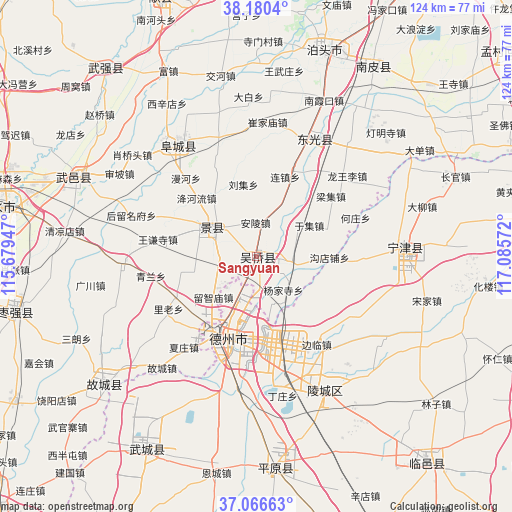
Sangyuan GPS coordinates[2]
37° 37' 32.16" North, 116° 22' 57.324" East
| Map corner | latitude | longitude |
|---|---|---|
| Upper-left | 38.1804°, | 115.67947° |
| Center: | 37.6256°, | 116.38259° |
| Lower-right: | 37.06663°, | 117.08572° |
| Map W x H: | 123.8×123.8 km | = 76.9×76.9mi |
| max Lat: | 53.31946° ⇑19.5% North |
| Sangyuan: | 37.6256° |
| min Lat: | ⇓80.5% South 18.22056° |
| min Long | Sangyuan | max Long |
| 75.07348° | 116.38259° | 134.28917° |
| W 62.3%⇐ | ⇒37.7% E |
Elevation
Elevation of Sangyuan is 19 m = 62 ft, and this is 465.8 m = 1528 ft below average elevation for this country.
| Max E: |
5622 m = 18445 ft | 83.4% |
| Avg. | 484.8 m = 1591 ft | |
| Sangyuan | 19 m = 62 ft | |
Min E: |
-3 m = -10 ft | 16.6% |
See also: China elevation on elevation.city.
Geographical zone
Sangyuan is located in North temperate zone (between Tropic of Cancer and the Arctic Circle). Distance of this Northern Tropic circle is 1577.7 km =980.3 mi to South.| Distance of | km | miles | from Sangyuan |
|---|---|---|---|
| North Pole | 5823.5 | 3618.6 | to North |
| Arctic Circle | 3217.6 | 1999.3 | to North |
| Tropic Cancer | 1577.7 | 980.3 | to South |
| Equator | 4183.6 | 2599.6 | to South |


Nearby cities:
15 places around Sangyuan: (largest is in red/bold)
• Botou
51.6 km =32.1 mi,  18°
18°
• Dengmingsi
43.9 km =27.3 mi,  45°
45°
• Dezhou
20.4 km =12.7 mi,  198°
198°
• Dongguang
31.7 km =19.7 mi, 24°
• Duancun
78 km =48.5 mi,  334°
334°
• Fucheng
33.9 km =21.1 mi,  323°
323°
• Hengshui
61.1 km =38 mi,  281°
281°
• Jiamaying
60.1 km =37.3 mi,  219°
219°
• Jingzhou
12.9 km =8 mi,  302°
302°
• Laocheng
69.2 km =43 mi, 219°
• Lingcheng
36.6 km =22.7 mi,  153°
153°
• Nanpi
53.2 km =33.1 mi,  31°
31°
• Ningjin
36.3 km =22.6 mi,  85°
85°
• Xiliguantun
72.3 km =44.9 mi,  212°
212°
• Xinhu
21.3 km =13.2 mi, 200°
Sources, notices
• [Note1] Compared only with cities in China existing in our database
• [Src1] Map data: © OpenStreetMap contributors (CC-BY-SA)
• [Src2] Other city data from geonames.org with taken over terms of usage.
• [Src3] Geographical zone / Annual Mean Temperature by Robert A. Rohde @ Wikipedia
