Hongsipu geodata
Hongsipu (Ningxia Hui Autonomous Region) is a seat of a third-order administrative division; located in China in Asia/Shanghai (GMT+8) time zone. In our database, there are 1268 cities with bigger population. Compared to other cities in China, 80% of cities are located further ↓South; 86.7% of cities are located further →East and 89.7% of cities have lower elevation than Hongsipu. Note1


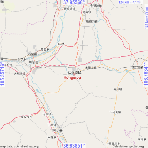
Hongsipu GPS coordinates[2]
37° 23' 57.012" North, 106° 3' 37.008" East
| Map corner | latitude | longitude |
|---|---|---|
| Upper-left | 37.95566°, | 105.35716° |
| Center: | 37.39917°, | 106.06028° |
| Lower-right: | 36.83851°, | 106.76341° |
| Map W x H: | 124.2×124.2 km | = 77.2×77.2mi |
| max Lat: | 53.31946° ⇑20% North |
| Hongsipu: | 37.39917° |
| min Lat: | ⇓80% South 18.22056° |
| min Long | Hongsipu | max Long |
| 75.07348° | 106.06028° | 134.28917° |
| W 13.3%⇐ | ⇒86.7% E |
Elevation
Elevation of Hongsipu is 1338 m = 4390 ft, and this is 853.2 m = 2799 ft above average elevation for this country.
| Max E: |
5622 m = 18445 ft | 10.3% |
| Hongsipu | 1338 m 4390 ft | |
| Avg. | 484.8 m = 1591 ft | |
Min E: |
-3 m = -10 ft | 89.7% |
See also: China elevation on elevation.city.
Geographical zone
Hongsipu is located in North temperate zone (between Tropic of Cancer and the Arctic Circle). Distance of this Northern Tropic circle is 1552.5 km =964.7 mi to South.| Distance of | km | miles | from Hongsipu |
|---|---|---|---|
| North Pole | 5848.7 | 3634.2 | to North |
| Arctic Circle | 3242.8 | 2015 | to North |
| Tropic Cancer | 1552.5 | 964.7 | to South |
| Equator | 4158.4 | 2583.9 | to South |


Nearby cities:
15 places around Hongsipu: (largest is in red/bold)
• Binhe
78.3 km =48.7 mi,  279°
279°
• Dongta
79.9 km =49.6 mi,  18°
18°
• Gancheng
93.2 km =57.9 mi,  164°
164°
• Liwang
81.4 km =50.6 mi,  177°
177°
• Luochuan
87.7 km =54.5 mi, 183°
• Magaozhuang
67.5 km =41.9 mi,  149°
149°
• Nanqiu
80.9 km =50.3 mi,  133°
133°
• Ning’an
35.6 km =22.1 mi,  287°
287°
• Shengli
66.2 km =41.1 mi,  10°
10°
• Wuzhong
66.5 km =41.3 mi, 10°
• Yanglu
85.1 km =52.9 mi, 175°
• Yuhai
48.4 km =30.1 mi,  196°
196°
• Yuwang
70.4 km =43.7 mi, 156°
• Zhangjiayuan
79.1 km =49.2 mi, 162°
• Zhongwei
77.8 km =48.3 mi, 279°
Sources, notices
• [Note1] Compared only with cities in China existing in our database
• [Src1] Map data: © OpenStreetMap contributors (CC-BY-SA)
• [Src2] Other city data from geonames.org with taken over terms of usage.
• [Src3] Geographical zone / Annual Mean Temperature by Robert A. Rohde @ Wikipedia
