Shengli geodata
Shengli (Ningxia Hui Autonomous Region) is a seat of a third-order administrative division; located in China in Asia/Shanghai (GMT+8) time zone. In our database, there are 1268 cities with bigger population. Compared to other cities in China, 80.9% of cities are located further ↓South; 86.1% of cities are located further →East and 87.3% of cities have lower elevation than Shengli. Note1


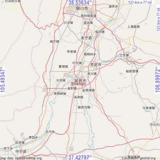
Shengli GPS coordinates[2]
37° 59' 3.3" North, 106° 11' 47.724" East
| Map corner | latitude | longitude |
|---|---|---|
| Upper-left | 38.53634°, | 105.49347° |
| Center: | 37.98425°, | 106.19659° |
| Lower-right: | 37.42797°, | 106.89972° |
| Map W x H: | 123.2×123.2 km | = 76.6×76.6mi |
| max Lat: | 53.31946° ⇑19.1% North |
| Shengli: | 37.98425° |
| min Lat: | ⇓80.9% South 18.22056° |
| min Long | Shengli | max Long |
| 75.07348° | 106.19659° | 134.28917° |
| W 13.9%⇐ | ⇒86.1% E |
Elevation
Elevation of Shengli is 1134 m = 3720 ft, and this is 649.2 m = 2130 ft above average elevation for this country.
| Max E: |
5622 m = 18445 ft | 12.7% |
| Shengli | 1134 m 3720 ft | |
| Avg. | 484.8 m = 1591 ft | |
Min E: |
-3 m = -10 ft | 87.3% |
See also: China elevation on elevation.city.
Geographical zone
Shengli is located in North temperate zone (between Tropic of Cancer and the Arctic Circle). Distance of this Northern Tropic circle is 1617.5 km =1005.1 mi to South.| Distance of | km | miles | from Shengli |
|---|---|---|---|
| North Pole | 5783.6 | 3593.8 | to North |
| Arctic Circle | 3177.7 | 1974.5 | to North |
| Tropic Cancer | 1617.5 | 1005.1 | to South |
| Equator | 4223.5 | 2624.4 | to South |


Nearby cities:
15 places around Shengli: (largest is in red/bold)
• Bayan Hot
105.5 km =65.6 mi,  334°
334°
• Binhe
103.4 km =64.2 mi,  239°
239°
• Dawukou
118.9 km =73.9 mi,  8°
8°
• Dongta
16.9 km =10.5 mi,  50°
50°
• Hongsipu
66.2 km =41.1 mi,  190°
190°
• Huamachi
108.2 km =67.2 mi,  101°
101°
• Ning’an
70.9 km =44.1 mi,  220°
220°
• Oljoq
114 km =70.8 mi,  79°
79°
• Pingluo Chengguanzhen
106.6 km =66.2 mi,  16°
16°
• Wuzhong
0.5 km =0.3 mi, 54°
• Xigang
64.6 km =40.1 mi, 11°
• Yanghe
33 km =20.5 mi, 7°
• Yinchuan
54.2 km =33.7 mi, 7°
• Yuhai
114.4 km =71.1 mi, 192°
• Zhongwei
102.9 km =63.9 mi, 239°
Sources, notices
• [Note1] Compared only with cities in China existing in our database
• [Src1] Map data: © OpenStreetMap contributors (CC-BY-SA)
• [Src2] Other city data from geonames.org with taken over terms of usage.
• [Src3] Geographical zone / Annual Mean Temperature by Robert A. Rohde @ Wikipedia
