Chensan geodata
Chensan (Hebei) is a seat of a fourth-order administrative division; located in China in Asia/Shanghai (GMT+8) time zone. In our database, there are 1268 cities with bigger population. Compared to other cities in China, 78.6% of cities are located further ↓South; 55% of cities are located further ←West and 73% of cities have higher elevation than Chensan. Note1


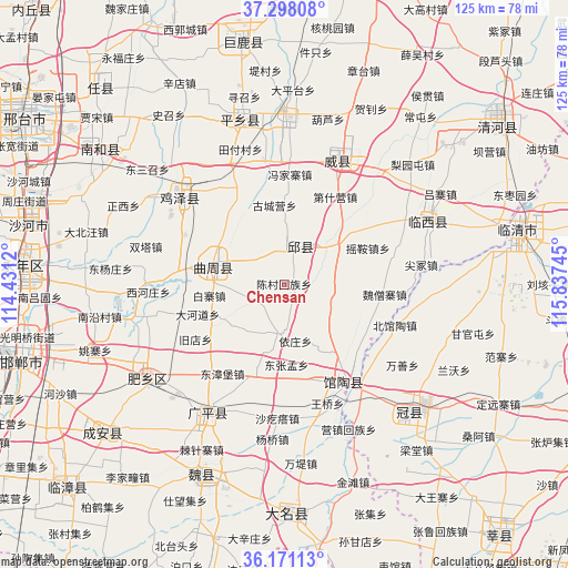
Chensan GPS coordinates[2]
36° 44' 12.012" North, 115° 8' 3.552" East
| Map corner | latitude | longitude |
|---|---|---|
| Upper-left | 37.29808°, | 114.4312° |
| Center: | 36.73667°, | 115.13432° |
| Lower-right: | 36.17113°, | 115.83745° |
| Map W x H: | 125.3×125.3 km | = 77.9×77.9mi |
| max Lat: | 53.31946° ⇑21.4% North |
| Chensan: | 36.73667° |
| min Lat: | ⇓78.6% South 18.22056° |
| min Long | Chensan | max Long |
| 75.07348° | 115.13432° | 134.28917° |
| W 55%⇐ | ⇒45% E |
Elevation
Elevation of Chensan is 42 m = 138 ft, and this is 442.8 m = 1453 ft below average elevation for this country.
| Max E: |
5622 m = 18445 ft | 73% |
| Avg. | 484.8 m = 1591 ft | |
| Chensan | 42 m = 138 ft | |
Min E: |
-3 m = -10 ft | 27% |
See also: China elevation on elevation.city.
Geographical zone
Chensan is located in North temperate zone (between Tropic of Cancer and the Arctic Circle). Distance of this Northern Tropic circle is 1478.8 km =918.9 mi to South.| Distance of | km | miles | from Chensan |
|---|---|---|---|
| North Pole | 5922.3 | 3679.9 | to North |
| Arctic Circle | 3316.4 | 2060.7 | to North |
| Tropic Cancer | 1478.8 | 918.9 | to South |
| Equator | 4084.7 | 2538.1 | to South |


Nearby cities:
15 places around Chensan: (largest is in red/bold)
• Daming
50.1 km =31.1 mi,  179°
179°
• Dongliang’erzhuang
10.9 km =6.8 mi,  95°
95°
• Dongluqiao
19.4 km =12.1 mi,  108°
108°
• Gaobeijie
50.7 km =31.5 mi,  74°
74°
• Guancheng
39.2 km =24.4 mi,  136°
136°
• Guantao
25.5 km =15.8 mi,  148°
148°
• Handan
61.3 km =38.1 mi,  255°
255°
• Liuzhuang
64.2 km =39.9 mi,  62°
62°
• Mingzhou
28.8 km =17.9 mi,  22°
22°
• Qiangezhai
33.3 km =20.7 mi,  40°
40°
• Qingnian
52.7 km =32.7 mi,  77°
77°
• Shahecheng
60.3 km =37.5 mi,  291°
291°
• Xinmatou
9.6 km =6 mi, 19°
• Xiying
35.1 km =21.8 mi,  155°
155°
• Youfang
64.2 km =39.9 mi, 61°
Sources, notices
• [Note1] Compared only with cities in China existing in our database
• [Src1] Map data: © OpenStreetMap contributors (CC-BY-SA)
• [Src2] Other city data from geonames.org with taken over terms of usage.
• [Src3] Geographical zone / Annual Mean Temperature by Robert A. Rohde @ Wikipedia
