Fengcheng geodata
Fengcheng (Guangxi) is a seat of a third-order administrative division; located in China in Asia/Shanghai (GMT+8) time zone. In our database, there are 1268 cities with bigger population. Compared to other cities in China, 88.2% of cities are located further ↑North; 83.6% of cities are located further →East and 76.3% of cities have lower elevation than Fengcheng. Note1


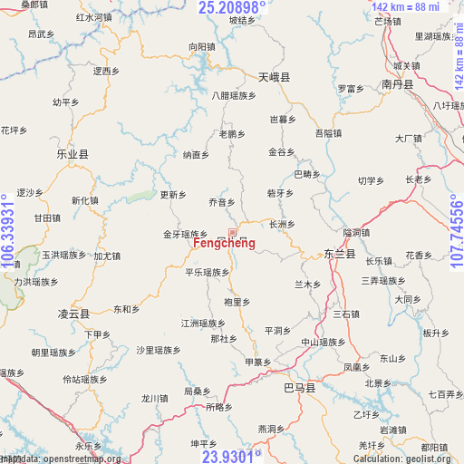
Fengcheng GPS coordinates[2]
24° 34' 16.212" North, 107° 2' 32.748" East
| Map corner | latitude | longitude |
|---|---|---|
| Upper-left | 25.20898°, | 106.33931° |
| Center: | 24.57117°, | 107.04243° |
| Lower-right: | 23.9301°, | 107.74556° |
| Map W x H: | 142.2×142.2 km | = 88.4×88.4mi |
| max Lat: | 53.31946° ⇑88.2% North |
| Fengcheng: | 24.57117° |
| min Lat: | ⇓11.8% South 18.22056° |
| min Long | Fengcheng | max Long |
| 75.07348° | 107.04243° | 134.28917° |
| W 16.4%⇐ | ⇒83.6% E |
Elevation
Elevation of Fengcheng is 554 m = 1818 ft, and this is 69.2 m = 227 ft above average elevation for this country.
| Max E: |
5622 m = 18445 ft | 23.7% |
| Fengcheng | 554 m 1818 ft | |
| Avg. | 484.8 m = 1591 ft | |
Min E: |
-3 m = -10 ft | 76.3% |
See also: China elevation on elevation.city.
Geographical zone
Fengcheng is located in North temperate zone (between Tropic of Cancer and the Arctic Circle). Distance of this Northern Tropic circle is 126.1 km =78.4 mi to South.| Distance of | km | miles | from Fengcheng |
|---|---|---|---|
| North Pole | 7275 | 4520.5 | to North |
| Arctic Circle | 4669.1 | 2901.2 | to North |
| Tropic Cancer | 126.1 | 78.4 | to South |
| Equator | 2732.1 | 1697.6 | to South |


Nearby cities:
15 places around Fengcheng: (largest is in red/bold)
• Anyang
128.1 km =79.6 mi,  123°
123°
• Baise City
86.4 km =53.7 mi,  210°
210°
• Bama
49.2 km =30.6 mi,  154°
154°
• Chuanshan
118.6 km =73.7 mi,  62°
62°
• Dahua
130.8 km =81.3 mi,  133°
133°
• Donglan
34.5 km =21.4 mi,  93°
93°
• Leli
84.4 km =52.4 mi,  253°
253°
• Liupai
53.8 km =33.4 mi,  14°
14°
• Maolan
138.3 km =85.9 mi,  48°
48°
• Nandan Chengguanzhen
71.3 km =44.3 mi, 46°
• Pingma
104 km =64.6 mi,  176°
176°
• Sicheng
50.1 km =31.1 mi, 248°
• Si’en
127.8 km =79.4 mi,  76°
76°
• Tianzhou
89.3 km =55.5 mi,  189°
189°
• Tongle
56.2 km =34.9 mi,  303°
303°
Sources, notices
• [Note1] Compared only with cities in China existing in our database
• [Src1] Map data: © OpenStreetMap contributors (CC-BY-SA)
• [Src2] Other city data from geonames.org with taken over terms of usage.
• [Src3] Geographical zone / Annual Mean Temperature by Robert A. Rohde @ Wikipedia
