Renhuai geodata
Renhuai (Guizhou) is a seat of a third-order administrative division; located in China in Asia/Shanghai (GMT+8) time zone. In our database, there are 1268 cities with bigger population. Compared to other cities in China, 75.3% of cities are located further ↑North; 85.5% of cities are located further →East and 83% of cities have lower elevation than Renhuai. Note1


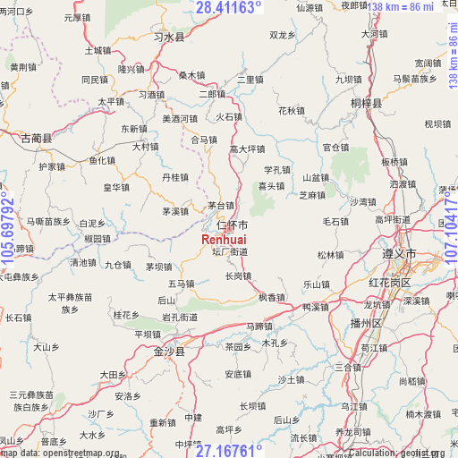
Renhuai GPS coordinates[2]
27° 47' 29.04" North, 106° 24' 3.744" East
| Map corner | latitude | longitude |
|---|---|---|
| Upper-left | 28.41163°, | 105.69792° |
| Center: | 27.7914°, | 106.40104° |
| Lower-right: | 27.16761°, | 107.10417° |
| Map W x H: | 138.3×138.3 km | = 85.9×85.9mi |
| max Lat: | 53.31946° ⇑75.3% North |
| Renhuai: | 27.7914° |
| min Lat: | ⇓24.7% South 18.22056° |
| min Long | Renhuai | max Long |
| 75.07348° | 106.40104° | 134.28917° |
| W 14.5%⇐ | ⇒85.5% E |
Elevation
Elevation of Renhuai is 848 m = 2782 ft, and this is 363.2 m = 1192 ft above average elevation for this country.
| Max E: |
5622 m = 18445 ft | 17% |
| Renhuai | 848 m 2782 ft | |
| Avg. | 484.8 m = 1591 ft | |
Min E: |
-3 m = -10 ft | 83% |
See also: China elevation on elevation.city.
Geographical zone
Renhuai is located in North temperate zone (between Tropic of Cancer and the Arctic Circle). Distance of this Northern Tropic circle is 484.2 km =300.9 mi to South.| Distance of | km | miles | from Renhuai |
|---|---|---|---|
| North Pole | 6916.9 | 4298 | to North |
| Arctic Circle | 4311.1 | 2678.8 | to North |
| Tropic Cancer | 484.2 | 300.9 | to South |
| Equator | 3090.1 | 1920.1 | to South |


Nearby cities:
15 places around Renhuai: (largest is in red/bold)
• Daba
25.1 km =15.6 mi,  6°
6°
• Dacun
35.6 km =22.1 mi,  315°
315°
• Guancang
41.1 km =25.5 mi,  48°
48°
• Guandian
59.5 km =37 mi,  20°
20°
• Hema
28.4 km =17.6 mi,  345°
345°
• Huaqiu
41.2 km =25.6 mi,  28°
28°
• Liziba
57.5 km =35.7 mi,  38°
38°
• Loushanguan
56.4 km =35 mi, 47°
• Sangmu
48.9 km =30.4 mi,  344°
344°
• Sanhe
31.3 km =19.4 mi, 350°
• Shatan
37.7 km =23.4 mi, 339°
• Taiping
52.8 km =32.8 mi, 317°
• Tongmin
59.2 km =36.8 mi, 317°
• Yong’an
45.9 km =28.5 mi,  2°
2°
• Zunyi
51.2 km =31.8 mi,  103°
103°
Sources, notices
• [Note1] Compared only with cities in China existing in our database
• [Src1] Map data: © OpenStreetMap contributors (CC-BY-SA)
• [Src2] Other city data from geonames.org with taken over terms of usage.
• [Src3] Geographical zone / Annual Mean Temperature by Robert A. Rohde @ Wikipedia
