Meihekou geodata
Meihekou (Jilin) is a populated place; located in China in Asia/Shanghai (GMT+8) time zone. With population of 99,419 people, there are 428 cities with bigger population in this country. Compared to other cities in China, 91.4% of cities are located further ↓South; 95.2% of cities are located further ←West and 65.2% of cities have lower elevation than Meihekou. Note1


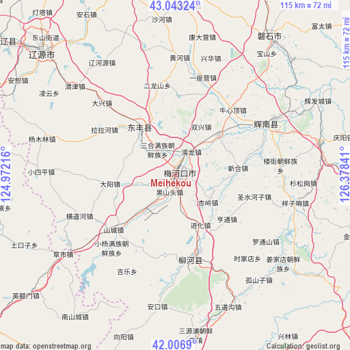
Meihekou GPS coordinates[2]
42° 31' 37.992" North, 125° 40' 31.008" East
| Map corner | latitude | longitude |
|---|---|---|
| Upper-left | 43.04324°, | 124.97216° |
| Center: | 42.52722°, | 125.67528° |
| Lower-right: | 42.0069°, | 126.37841° |
| Map W x H: | 115.2×115.2 km | = 71.6×71.6mi |
| max Lat: | 53.31946° ⇑8.6% North |
| Meihekou: | 42.52722° |
| min Lat: | ⇓91.4% South 18.22056° |
| min Long | Meihekou | max Long |
| 75.07348° | 125.67528° | 134.28917° |
| W 95.2%⇐ | ⇒4.8% E |
Elevation
Elevation of Meihekou is 329 m = 1079 ft, and this is 155.8 m = 511 ft below average elevation for this country.
| Max E: |
5622 m = 18445 ft | 34.8% |
| Avg. | 484.8 m = 1591 ft | |
| Meihekou | 329 m = 1079 ft | |
Min E: |
-3 m = -10 ft | 65.2% |
See also: Meihekou elevation on elevation.city.
Geographical zone
Meihekou is located in North temperate zone (between Tropic of Cancer and the Arctic Circle). Distance of this Northern Tropic circle is 2122.7 km =1319 mi to South.| Distance of | km | miles | from Meihekou |
|---|---|---|---|
| North Pole | 5278.5 | 3279.9 | to North |
| Arctic Circle | 2672.6 | 1660.7 | to North |
| Tropic Cancer | 2122.7 | 1319 | to South |
| Equator | 4728.6 | 2938.2 | to South |


Nearby cities:
15 places around Meihekou: (largest is in red/bold)
• Baiquan
70.8 km =44 mi,  304°
304°
• Chaoyang
32.4 km =20.1 mi,  62°
62°
• Dahuanggou
64.7 km =40.2 mi,  144°
144°
• Dongfeng
18.4 km =11.4 mi,  313°
313°
• Ermi
83.2 km =51.7 mi,  171°
171°
• Gangou
73.9 km =45.9 mi,  177°
177°
• Guanghua
69.5 km =43.2 mi,  158°
158°
• Huinan
49.1 km =30.5 mi,  77°
77°
• Hulutao
84.5 km =52.5 mi, 165°
• Liaoyuan
60.8 km =37.8 mi, 313°
• Liuhe
32.1 km =19.9 mi, 173°
• Panshi
55.6 km =34.5 mi,  33°
33°
• Sipeng
74.4 km =46.2 mi,  186°
186°
• Tongshanjie
77.8 km =48.3 mi, 169°
• Xifeng
81.4 km =50.6 mi,  286°
286°
Sources, notices
• [Note1] Compared only with cities in China existing in our database
• [Src1] Map data: © OpenStreetMap contributors (CC-BY-SA)
• [Src2] Other city data from geonames.org with taken over terms of usage.
• [Src3] Geographical zone / Annual Mean Temperature by Robert A. Rohde @ Wikipedia
