Chaoyang geodata
Chaoyang (Jilin) is a seat of a third-order administrative division; located in China in Asia/Shanghai (GMT+8) time zone. With population of 75,347 people, there are 567 cities with bigger population in this country. Compared to other cities in China, 91.5% of cities are located further ↓South; 95.6% of cities are located further ←West and 63.1% of cities have lower elevation than Chaoyang. Note1


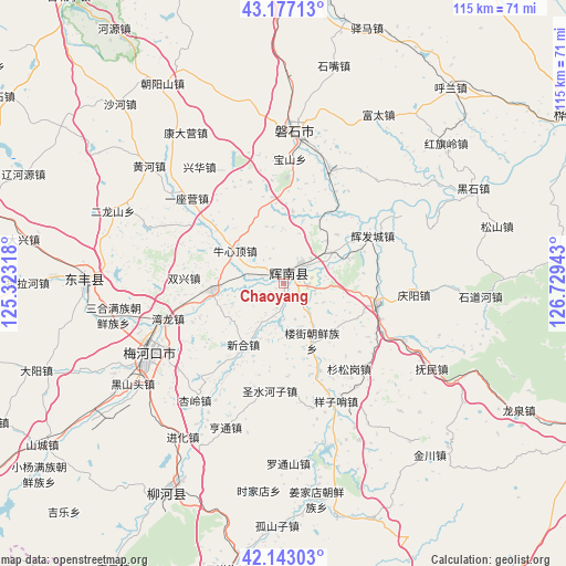
Chaoyang GPS coordinates[2]
42° 39' 44.028" North, 126° 1' 34.68" East
| Map corner | latitude | longitude |
|---|---|---|
| Upper-left | 43.17713°, | 125.32318° |
| Center: | 42.66223°, | 126.0263° |
| Lower-right: | 42.14303°, | 126.72943° |
| Map W x H: | 115×115 km | = 71.5×71.5mi |
| max Lat: | 53.31946° ⇑8.5% North |
| Chaoyang: | 42.66223° |
| min Lat: | ⇓91.5% South 18.22056° |
| min Long | Chaoyang | max Long |
| 75.07348° | 126.0263° | 134.28917° |
| W 95.6%⇐ | ⇒4.4% E |
Elevation
Elevation of Chaoyang is 297 m = 974 ft, and this is 187.8 m = 616 ft below average elevation for this country.
| Max E: |
5622 m = 18445 ft | 36.9% |
| Avg. | 484.8 m = 1591 ft | |
| Chaoyang | 297 m = 974 ft | |
Min E: |
-3 m = -10 ft | 63.1% |
See also: Chaoyang elevation on elevation.city.
Geographical zone
Chaoyang is located in North temperate zone (between Tropic of Cancer and the Arctic Circle). Distance of this Northern Tropic circle is 2137.7 km =1328.3 mi to South.| Distance of | km | miles | from Chaoyang |
|---|---|---|---|
| North Pole | 5263.5 | 3270.6 | to North |
| Arctic Circle | 2657.6 | 1651.4 | to North |
| Tropic Cancer | 2137.7 | 1328.3 | to South |
| Equator | 4743.6 | 2947.5 | to South |


Nearby cities:
15 places around Chaoyang: (largest is in red/bold)
• Dahuanggou
68.5 km =42.6 mi,  173°
173°
• Dongfeng
42.1 km =26.2 mi,  266°
266°
• Dujia
70.9 km =44.1 mi,  91°
91°
• Gongji
79.3 km =49.3 mi,  62°
62°
• Huadian
67.7 km =42.1 mi, 60°
• Huinan
19.7 km =12.2 mi,  102°
102°
• Jingyu
71.2 km =44.2 mi,  116°
116°
• Jinjiadian
79.1 km =49.2 mi, 116°
• Jiujianfang
75.5 km =46.9 mi, 63°
• Liaoyuan
77.5 km =48.2 mi,  290°
290°
• Liuhe
53.4 km =33.2 mi,  208°
208°
• Meihekou
32.4 km =20.1 mi,  242°
242°
• Na’erhong
79 km =49.1 mi, 87°
• Panshi
31.2 km =19.4 mi,  4°
4°
• Yantongshan
70 km =43.5 mi,  358°
358°
Sources, notices
• [Note1] Compared only with cities in China existing in our database
• [Src1] Map data: © OpenStreetMap contributors (CC-BY-SA)
• [Src2] Other city data from geonames.org with taken over terms of usage.
• [Src3] Geographical zone / Annual Mean Temperature by Robert A. Rohde @ Wikipedia
