Laoheishan geodata
Laoheishan (Heilongjiang) is a seat of a fourth-order administrative division; located in China in Asia/Shanghai (GMT+8) time zone. In our database, there are 1268 cities with bigger population. Compared to other cities in China, 92.4% of cities are located further ↓South; 99.8% of cities are located further ←West and 66.5% of cities have lower elevation than Laoheishan. Note1


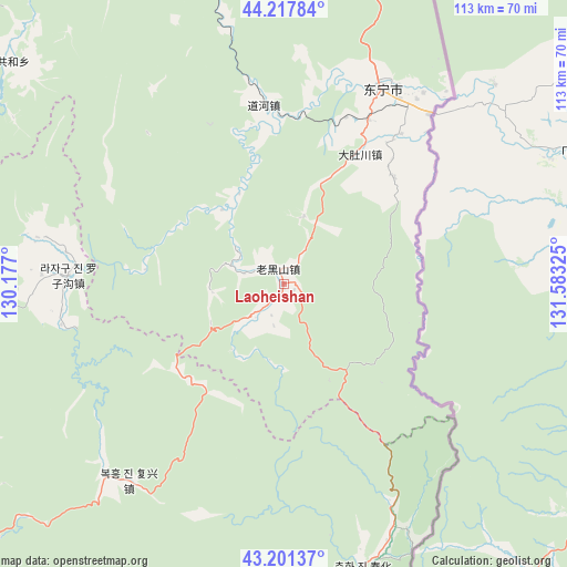
Laoheishan GPS coordinates[2]
43° 42' 42.336" North, 130° 52' 48.432" East
| Map corner | latitude | longitude |
|---|---|---|
| Upper-left | 44.21784°, | 130.177° |
| Center: | 43.71176°, | 130.88012° |
| Lower-right: | 43.20137°, | 131.58325° |
| Map W x H: | 113×113 km | = 70.2×70.2mi |
| max Lat: | 53.31946° ⇑7.6% North |
| Laoheishan: | 43.71176° |
| min Lat: | ⇓92.4% South 18.22056° |
| min Long | Laoheishan | max Long |
| 75.07348° | 130.88012° | 134.28917° |
| W 99.8%⇐ | ⇒0.2% E |
Elevation
Elevation of Laoheishan is 352 m = 1155 ft, and this is 132.8 m = 436 ft below average elevation for this country.
| Max E: |
5622 m = 18445 ft | 33.5% |
| Avg. | 484.8 m = 1591 ft | |
| Laoheishan | 352 m = 1155 ft | |
Min E: |
-3 m = -10 ft | 66.5% |
See also: China elevation on elevation.city.
Geographical zone
Laoheishan is located in North temperate zone (between Tropic of Cancer and the Arctic Circle). Distance of this Northern Tropic circle is 2254.4 km =1400.8 mi to South.| Distance of | km | miles | from Laoheishan |
|---|---|---|---|
| North Pole | 5146.8 | 3198.1 | to North |
| Arctic Circle | 2540.9 | 1578.8 | to North |
| Tropic Cancer | 2254.4 | 1400.8 | to South |
| Equator | 4860.3 | 3020 | to South |


Nearby cities:
15 places around Laoheishan: (largest is in red/bold)
• Daduchuan
30 km =18.6 mi,  30°
30°
• Daohe
36 km =22.4 mi,  353°
353°
• Dongguang
98.3 km =61.1 mi,  241°
241°
• Dongning
43.5 km =27 mi, 26°
• Gonghe
70 km =43.5 mi,  309°
309°
• Jiguan
86.2 km =53.6 mi,  252°
252°
• Jincang
50.4 km =31.3 mi,  219°
219°
• Luozigou
43.4 km =27 mi,  272°
272°
• Mijiang
99.5 km =61.8 mi, 216°
• Sanchakou Chaoxianzu
44.4 km =27.6 mi,  40°
40°
• Suifenhe
79.4 km =49.3 mi,  15°
15°
• Suiyang
79 km =49.1 mi,  0°
0°
• Xitumenzi
59.5 km =37 mi,  164°
164°
• Yangmulinzi
95.2 km =59.2 mi,  199°
199°
• Zhongxin
92.6 km =57.5 mi, 200°
Sources, notices
• [Note1] Compared only with cities in China existing in our database
• [Src1] Map data: © OpenStreetMap contributors (CC-BY-SA)
• [Src2] Other city data from geonames.org with taken over terms of usage.
• [Src3] Geographical zone / Annual Mean Temperature by Robert A. Rohde @ Wikipedia
