Jingpeng geodata
Jingpeng (Inner Mongolia) is a seat of a third-order administrative division; located in China in Asia/Shanghai (GMT+8) time zone. In our database, there are 1268 cities with bigger population. Compared to other cities in China, 92.2% of cities are located further ↓South; 68.8% of cities are located further ←West and 86.8% of cities have lower elevation than Jingpeng. Note1


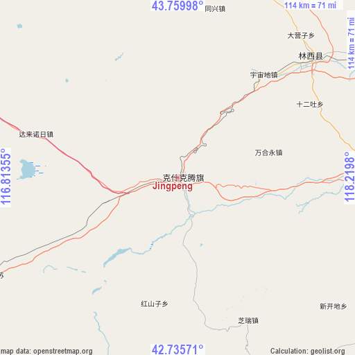
Jingpeng GPS coordinates[2]
43° 15' 0" North, 117° 31' 0.012" East
| Map corner | latitude | longitude |
|---|---|---|
| Upper-left | 43.75998°, | 116.81355° |
| Center: | 43.25°, | 117.51667° |
| Lower-right: | 42.73571°, | 118.2198° |
| Map W x H: | 113.9×113.9 km | = 70.8×70.8mi |
| max Lat: | 53.31946° ⇑7.8% North |
| Jingpeng: | 43.25° |
| min Lat: | ⇓92.2% South 18.22056° |
| min Long | Jingpeng | max Long |
| 75.07348° | 117.51667° | 134.28917° |
| W 68.8%⇐ | ⇒31.2% E |
Elevation
Elevation of Jingpeng is 1100 m = 3609 ft, and this is 615.2 m = 2018 ft above average elevation for this country.
| Max E: |
5622 m = 18445 ft | 13.2% |
| Jingpeng | 1100 m 3609 ft | |
| Avg. | 484.8 m = 1591 ft | |
Min E: |
-3 m = -10 ft | 86.8% |
See also: China elevation on elevation.city.
Geographical zone
Jingpeng is located in North temperate zone (between Tropic of Cancer and the Arctic Circle). Distance of this Northern Tropic circle is 2203 km =1368.9 mi to South.| Distance of | km | miles | from Jingpeng |
|---|---|---|---|
| North Pole | 5198.1 | 3229.9 | to North |
| Arctic Circle | 2592.2 | 1610.7 | to North |
| Tropic Cancer | 2203 | 1368.9 | to South |
| Equator | 4808.9 | 2988.1 | to South |


Nearby cities:
15 places around Jingpeng: (largest is in red/bold)
• Bala Ga’er Gaole
149.4 km =92.8 mi,  3°
3°
• Bayan Bulag
166.7 km =103.6 mi,  310°
310°
• Chifeng
160.8 km =99.9 mi,  132°
132°
• Daban
98.1 km =61 mi,  71°
71°
• Duolun
145 km =90.1 mi,  215°
215°
• Jirin Gol
140 km =87 mi,  345°
345°
• Lindong
157 km =97.6 mi,  58°
58°
• Linxi
51.2 km =31.8 mi,  54°
54°
• Mujiayingzi
163.1 km =101.3 mi,  140°
140°
• Shangdu
165.9 km =103.1 mi,  227°
227°
• Subrag
130.3 km =81 mi,  35°
35°
• Weichang
146.4 km =91 mi,  172°
172°
• Wudan
127.3 km =79.1 mi,  105°
105°
• Xilin Hot
143.6 km =89.2 mi,  303°
303°
• Xiritala
139.4 km =86.6 mi, 303°
Sources, notices
• [Note1] Compared only with cities in China existing in our database
• [Src1] Map data: © OpenStreetMap contributors (CC-BY-SA)
• [Src2] Other city data from geonames.org with taken over terms of usage.
• [Src3] Geographical zone / Annual Mean Temperature by Robert A. Rohde @ Wikipedia
