Daban geodata
Daban (Inner Mongolia) is a seat of a third-order administrative division; located in China in Asia/Shanghai (GMT+8) time zone. In our database, there are 1268 cities with bigger population. Compared to other cities in China, 92.3% of cities are located further ↓South; 74.2% of cities are located further ←West and 78.5% of cities have lower elevation than Daban. Note1


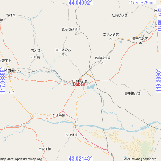
Daban GPS coordinates[2]
43° 31' 59.988" North, 118° 40' 0.012" East
| Map corner | latitude | longitude |
|---|---|---|
| Upper-left | 44.04092°, | 117.96355° |
| Center: | 43.53333°, | 118.66667° |
| Lower-right: | 43.02143°, | 119.3698° |
| Map W x H: | 113.4×113.4 km | = 70.5×70.5mi |
| max Lat: | 53.31946° ⇑7.7% North |
| Daban: | 43.53333° |
| min Lat: | ⇓92.3% South 18.22056° |
| min Long | Daban | max Long |
| 75.07348° | 118.66667° | 134.28917° |
| W 74.2%⇐ | ⇒25.8% E |
Elevation
Elevation of Daban is 632 m = 2073 ft, and this is 147.2 m = 483 ft above average elevation for this country.
| Max E: |
5622 m = 18445 ft | 21.5% |
| Daban | 632 m 2073 ft | |
| Avg. | 484.8 m = 1591 ft | |
Min E: |
-3 m = -10 ft | 78.5% |
See also: China elevation on elevation.city.
Geographical zone
Daban is located in North temperate zone (between Tropic of Cancer and the Arctic Circle). Distance of this Northern Tropic circle is 2234.5 km =1388.5 mi to South.| Distance of | km | miles | from Daban |
|---|---|---|---|
| North Pole | 5166.6 | 3210.4 | to North |
| Arctic Circle | 2560.7 | 1591.1 | to North |
| Tropic Cancer | 2234.5 | 1388.5 | to South |
| Equator | 4840.5 | 3007.7 | to South |


Nearby cities:
15 places around Daban: (largest is in red/bold)
• Baga Borihe
167.6 km =104.1 mi,  113°
113°
• Bala Ga’er Gaole
144.2 km =89.6 mi,  324°
324°
• Bayan Tal
172.2 km =107 mi,  55°
55°
• Chifeng
142.7 km =88.7 mi,  170°
170°
• Holt
108.8 km =67.6 mi,  23°
23°
• Jingpeng
98.1 km =61 mi,  251°
251°
• Jirin Gol
164.8 km =102.4 mi,  309°
309°
• Lindong
65 km =40.4 mi,  39°
39°
• Linxi
51.1 km =31.8 mi,  267°
267°
• Mujiayingzi
157.8 km =98.1 mi,  176°
176°
• Pingzhuang
173.9 km =108.1 mi,  163°
163°
• Subrag
75.8 km =47.1 mi,  347°
347°
• Tianshan
121.2 km =75.3 mi,  71°
71°
• Wudan
72.6 km =45.1 mi, 156°
• Xinhui
171.3 km =106.4 mi,  144°
144°
Sources, notices
• [Note1] Compared only with cities in China existing in our database
• [Src1] Map data: © OpenStreetMap contributors (CC-BY-SA)
• [Src2] Other city data from geonames.org with taken over terms of usage.
• [Src3] Geographical zone / Annual Mean Temperature by Robert A. Rohde @ Wikipedia
