Shangdu geodata
Shangdu (Inner Mongolia) is a seat of a third-order administrative division; located in China in Asia/Shanghai (GMT+8) time zone. In our database, there are 1268 cities with bigger population. Compared to other cities in China, 91.2% of cities are located further ↓South; 60.1% of cities are located further ←West and 89.4% of cities have lower elevation than Shangdu. Note1


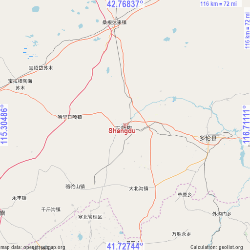
Shangdu GPS coordinates[2]
42° 15' 0.18" North, 116° 0' 28.728" East
| Map corner | latitude | longitude |
|---|---|---|
| Upper-left | 42.76837°, | 115.30486° |
| Center: | 42.25005°, | 116.00798° |
| Lower-right: | 41.72744°, | 116.71111° |
| Map W x H: | 115.7×115.7 km | = 71.9×71.9mi |
| max Lat: | 53.31946° ⇑8.8% North |
| Shangdu: | 42.25005° |
| min Lat: | ⇓91.2% South 18.22056° |
| min Long | Shangdu | max Long |
| 75.07348° | 116.00798° | 134.28917° |
| W 60.1%⇐ | ⇒39.9% E |
Elevation
Elevation of Shangdu is 1303 m = 4275 ft, and this is 818.2 m = 2684 ft above average elevation for this country.
| Max E: |
5622 m = 18445 ft | 10.6% |
| Shangdu | 1303 m 4275 ft | |
| Avg. | 484.8 m = 1591 ft | |
Min E: |
-3 m = -10 ft | 89.4% |
See also: China elevation on elevation.city.
Geographical zone
Shangdu is located in North temperate zone (between Tropic of Cancer and the Arctic Circle). Distance of this Northern Tropic circle is 2091.8 km =1299.8 mi to South.| Distance of | km | miles | from Shangdu |
|---|---|---|---|
| North Pole | 5309.3 | 3299 | to North |
| Arctic Circle | 2703.4 | 1679.8 | to North |
| Tropic Cancer | 2091.8 | 1299.8 | to South |
| Equator | 4697.8 | 2919.1 | to South |


Nearby cities:
15 places around Shangdu: (largest is in red/bold)
• Baochang
72.6 km =45.1 mi,  235°
235°
• Changshaoying
173.1 km =107.6 mi,  159°
159°
• Changshun
171.1 km =106.3 mi,  256°
256°
• Chicheng
154.5 km =96 mi,  185°
185°
• Dage
128.2 km =79.7 mi, 155°
• Duolun
40.2 km =25 mi,  100°
100°
• Jingpeng
165.9 km =103.1 mi,  47°
47°
• Kangbao
123.5 km =76.7 mi,  248°
248°
• Laba Goumen
158.6 km =98.5 mi, 161°
• Ming’antu
83.7 km =52 mi,  274°
274°
• Pingdingbu
69.9 km =43.4 mi,  201°
201°
• Qianjiadian
175.2 km =108.9 mi,  170°
170°
• Weichang
147.5 km =91.7 mi, 103°
• Xiwanzi
154.8 km =96.2 mi, 203°
• Zhangbei
162.9 km =101.2 mi,  221°
221°
Sources, notices
• [Note1] Compared only with cities in China existing in our database
• [Src1] Map data: © OpenStreetMap contributors (CC-BY-SA)
• [Src2] Other city data from geonames.org with taken over terms of usage.
• [Src3] Geographical zone / Annual Mean Temperature by Robert A. Rohde @ Wikipedia
