Dongke geodata
Dongke (Qinghai) is a seat of a fourth-order administrative division; located in China in Asia/Shanghai (GMT+8) time zone. In our database, there are 1268 cities with bigger population. Compared to other cities in China, 77.9% of cities are located further ↓South; 94.7% of cities are located further →East and 97% of cities have lower elevation than Dongke. Note1


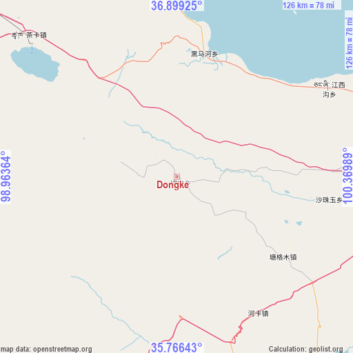
Dongke GPS coordinates[2]
36° 20' 5.64" North, 99° 40' 0.336" East
| Map corner | latitude | longitude |
|---|---|---|
| Upper-left | 36.89925°, | 98.96364° |
| Center: | 36.3349°, | 99.66676° |
| Lower-right: | 35.76643°, | 100.36989° |
| Map W x H: | 126×126 km | = 78.3×78.3mi |
| max Lat: | 53.31946° ⇑22.1% North |
| Dongke: | 36.3349° |
| min Lat: | ⇓77.9% South 18.22056° |
| min Long | Dongke | max Long |
| 75.07348° | 99.66676° | 134.28917° |
| W 5.3%⇐ | ⇒94.7% E |
Elevation
Elevation of Dongke is 3049 m = 10003 ft, and this is 2564.2 m = 8413 ft above average elevation for this country.
| Max E: |
5622 m = 18445 ft | 3% |
| Dongke | 3049 m 10003 ft | |
| Avg. | 484.8 m = 1591 ft | |
Min E: |
-3 m = -10 ft | 97% |
See also: China elevation on elevation.city.
Geographical zone
Dongke is located in North temperate zone (between Tropic of Cancer and the Arctic Circle). Distance of this Northern Tropic circle is 1434.1 km =891.1 mi to South.| Distance of | km | miles | from Dongke |
|---|---|---|---|
| North Pole | 5967 | 3707.7 | to North |
| Arctic Circle | 3361.1 | 2088.5 | to North |
| Tropic Cancer | 1434.1 | 891.1 | to South |
| Equator | 4040.1 | 2510.4 | to South |


Nearby cities:
15 places around Dongke: (largest is in red/bold)
• Chaka
73.4 km =45.6 mi,  313°
313°
• Gandi
62.5 km =38.8 mi,  83°
83°
• Heimahe
44.9 km =27.9 mi,  12°
12°
• Heka
57.2 km =35.5 mi,  149°
149°
• Jiangxigou
63.1 km =39.2 mi,  58°
58°
• Jirmeng
91.2 km =56.7 mi,  354°
354°
• Qabqa
85 km =52.8 mi,  94°
94°
• Qiecha
73.7 km =45.8 mi,  355°
355°
• Sangdang
95.7 km =59.5 mi,  161°
161°
• Sazhubxi
55.5 km =34.5 mi,  95°
95°
• Shinaihai
72.1 km =44.8 mi, 357°
• Tiegai
93.4 km =58 mi, 100°
• Tumba
98.9 km =61.5 mi, 87°
• Yingde’er
47.4 km =29.5 mi, 80°
• Ziketan
88.1 km =54.7 mi, 160°
Sources, notices
• [Note1] Compared only with cities in China existing in our database
• [Src1] Map data: © OpenStreetMap contributors (CC-BY-SA)
• [Src2] Other city data from geonames.org with taken over terms of usage.
• [Src3] Geographical zone / Annual Mean Temperature by Robert A. Rohde @ Wikipedia
