Heimahe geodata
Heimahe (Qinghai) is a seat of a fourth-order administrative division; located in China in Asia/Shanghai (GMT+8) time zone. In our database, there are 1268 cities with bigger population. Compared to other cities in China, 78.6% of cities are located further ↓South; 94.7% of cities are located further →East and 97.2% of cities have lower elevation than Heimahe. Note1


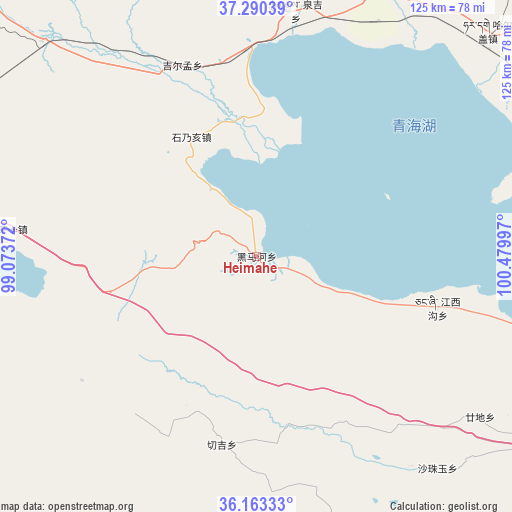
Heimahe GPS coordinates[2]
36° 43' 44.148" North, 99° 46' 36.624" East
| Map corner | latitude | longitude |
|---|---|---|
| Upper-left | 37.29039°, | 99.07372° |
| Center: | 36.72893°, | 99.77684° |
| Lower-right: | 36.16333°, | 100.47997° |
| Map W x H: | 125.3×125.3 km | = 77.9×77.9mi |
| max Lat: | 53.31946° ⇑21.4% North |
| Heimahe: | 36.72893° |
| min Lat: | ⇓78.6% South 18.22056° |
| min Long | Heimahe | max Long |
| 75.07348° | 99.77684° | 134.28917° |
| W 5.3%⇐ | ⇒94.7% E |
Elevation
Elevation of Heimahe is 3208 m = 10525 ft, and this is 2723.2 m = 8934 ft above average elevation for this country.
| Max E: |
5622 m = 18445 ft | 2.8% |
| Heimahe | 3208 m 10525 ft | |
| Avg. | 484.8 m = 1591 ft | |
Min E: |
-3 m = -10 ft | 97.2% |
See also: China elevation on elevation.city.
Geographical zone
Heimahe is located in North temperate zone (between Tropic of Cancer and the Arctic Circle). Distance of this Northern Tropic circle is 1478 km =918.4 mi to South.| Distance of | km | miles | from Heimahe |
|---|---|---|---|
| North Pole | 5923.2 | 3680.5 | to North |
| Arctic Circle | 3317.3 | 2061.3 | to North |
| Tropic Cancer | 1478 | 918.4 | to South |
| Equator | 4083.9 | 2537.6 | to South |


Nearby cities:
15 places around Heimahe: (largest is in red/bold)
• Chaka
63 km =39.1 mi,  276°
276°
• Dongke
44.9 km =27.9 mi,  192°
192°
• Gandi
63.7 km =39.6 mi,  125°
125°
• Hairag
79 km =49.1 mi,  45°
45°
• Jiangxigou
45 km =28 mi,  103°
103°
• Jirmeng
50.5 km =31.4 mi,  338°
338°
• Qabqa
89.8 km =55.8 mi,  123°
123°
• Qiecha
33.6 km =20.9 mi,  331°
331°
• Qinghaihu
93.8 km =58.3 mi,  82°
82°
• Sazhubxi
67.1 km =41.7 mi,  137°
137°
• Shaliuhe
73.6 km =45.7 mi,  25°
25°
• Shinaihai
31.1 km =19.3 mi, 334°
• Tuohua
89.6 km =55.7 mi,  64°
64°
• Xinyuan
93.7 km =58.2 mi,  312°
312°
• Yingde’er
51.4 km =31.9 mi, 134°
Sources, notices
• [Note1] Compared only with cities in China existing in our database
• [Src1] Map data: © OpenStreetMap contributors (CC-BY-SA)
• [Src2] Other city data from geonames.org with taken over terms of usage.
• [Src3] Geographical zone / Annual Mean Temperature by Robert A. Rohde @ Wikipedia
