Zhu Cheng City geodata
Zhu Cheng City (Shandong) is a seat of a third-order administrative division; located in China in Asia/Shanghai (GMT+8) time zone. With population of 1,000,000 people, there are 65 cities with bigger population in this country. Compared to other cities in China, 77.2% of cities are located further ↓South; 78.3% of cities are located further ←West and 66.4% of cities have higher elevation than Zhu Cheng City. Note1


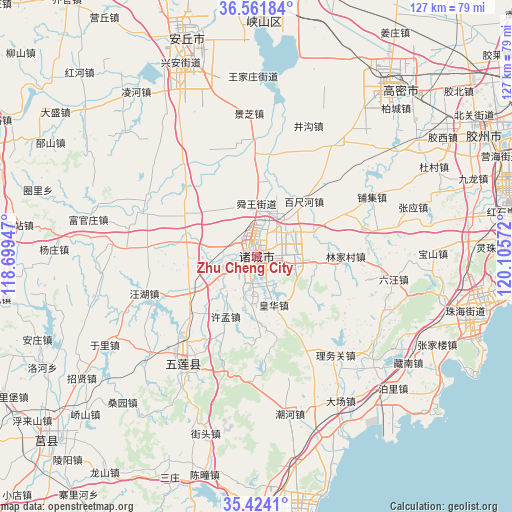
Zhu Cheng City GPS coordinates[2]
35° 59' 42.072" North, 119° 24' 9.324" East
| Map corner | latitude | longitude |
|---|---|---|
| Upper-left | 36.56184°, | 118.69947° |
| Center: | 35.99502°, | 119.40259° |
| Lower-right: | 35.4241°, | 120.10572° |
| Map W x H: | 126.5×126.5 km | = 78.6×78.6mi |
| max Lat: | 53.31946° ⇑22.8% North |
| Zhu Cheng City: | 35.99502° |
| min Lat: | ⇓77.2% South 18.22056° |
| min Long | Zhu Cheng City | max Long |
| 75.07348° | 119.40259° | 134.28917° |
| W 78.3%⇐ | ⇒21.7% E |
Elevation
Elevation of Zhu Cheng City is 67 m = 220 ft, and this is 417.8 m = 1371 ft below average elevation for this country.
| Max E: |
5622 m = 18445 ft | 66.4% |
| Avg. | 484.8 m = 1591 ft | |
| Zhu Cheng City | 67 m = 220 ft | |
Min E: |
-3 m = -10 ft | 33.6% |
See also: Zhu Cheng City elevation on elevation.city.
Geographical zone
Zhu Cheng City is located in North temperate zone (between Tropic of Cancer and the Arctic Circle). Distance of this Northern Tropic circle is 1396.4 km =867.7 mi to South.| Distance of | km | miles | from Zhu Cheng City |
|---|---|---|---|
| North Pole | 6004.8 | 3731.2 | to North |
| Arctic Circle | 3398.9 | 2112 | to North |
| Tropic Cancer | 1396.4 | 867.7 | to South |
| Equator | 4002.3 | 2486.9 | to South |


Nearby cities:
15 places around Zhu Cheng City: (largest is in red/bold)
• Anqiu
52.3 km =32.5 mi,  338°
338°
• Changjianglu Jiedao
69.4 km =43.1 mi,  92°
92°
• Chengyang
69.1 km =42.9 mi,  228°
228°
• Chengyang
94.2 km =58.5 mi,  68°
68°
• Gaomi
53.4 km =33.2 mi,  36°
36°
• Hanting
88 km =54.7 mi,  348°
348°
• Jiaozhou
62.8 km =39 mi,  59°
59°
• Kuiju
95.5 km =59.3 mi,  359°
359°
• Mizhou
0.5 km =0.3 mi,  265°
265°
• Qingdao
88.3 km =54.9 mi,  84°
84°
• Rizhao
63.3 km =39.3 mi,  175°
175°
• Rizhao
67.6 km =42 mi,  170°
170°
• Weifang
83.9 km =52.1 mi, 341°
• Yinzhu
53.2 km =33.1 mi,  104°
104°
• Yishui
73.6 km =45.7 mi,  251°
251°
Sources, notices
• [Note1] Compared only with cities in China existing in our database
• [Src1] Map data: © OpenStreetMap contributors (CC-BY-SA)
• [Src2] Other city data from geonames.org with taken over terms of usage.
• [Src3] Geographical zone / Annual Mean Temperature by Robert A. Rohde @ Wikipedia
