Chengyang geodata
Chengyang (Shandong) is a populated place; located in China in Asia/Shanghai (GMT+8) time zone. With population of 66,588 people, there are 644 cities with bigger population in this country. Compared to other cities in China, 76.2% of cities are located further ↓South; 75.2% of cities are located further ←West and 57.9% of cities have higher elevation than Chengyang. Note1


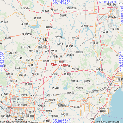
Chengyang GPS coordinates[2]
35° 34' 45.984" North, 118° 49' 58.008" East
| Map corner | latitude | longitude |
|---|---|---|
| Upper-left | 36.14925°, | 118.12966° |
| Center: | 35.57944°, | 118.83278° |
| Lower-right: | 35.00554°, | 119.53591° |
| Map W x H: | 127.2×127.2 km | = 79×79mi |
| max Lat: | 53.31946° ⇑23.8% North |
| Chengyang: | 35.57944° |
| min Lat: | ⇓76.2% South 18.22056° |
| min Long | Chengyang | max Long |
| 75.07348° | 118.83278° | 134.28917° |
| W 75.2%⇐ | ⇒24.8% E |
Elevation
Elevation of Chengyang is 112 m = 367 ft, and this is 372.8 m = 1223 ft below average elevation for this country.
| Max E: |
5622 m = 18445 ft | 57.9% |
| Avg. | 484.8 m = 1591 ft | |
| Chengyang | 112 m = 367 ft | |
Min E: |
-3 m = -10 ft | 42.1% |
See also: Chengyang elevation on elevation.city.
Geographical zone
Chengyang is located in North temperate zone (between Tropic of Cancer and the Arctic Circle). Distance of this Northern Tropic circle is 1350.1 km =838.9 mi to South.| Distance of | km | miles | from Chengyang |
|---|---|---|---|
| North Pole | 6051 | 3759.9 | to North |
| Arctic Circle | 3445.1 | 2140.7 | to North |
| Tropic Cancer | 1350.1 | 838.9 | to South |
| Equator | 3956.1 | 2458.2 | to South |


Nearby cities:
15 places around Chengyang: (largest is in red/bold)
• Andongwei
64.2 km =39.9 mi,  141°
141°
• Feicheng
86 km =53.4 mi,  245°
245°
• Haitou
78.1 km =48.5 mi,  156°
156°
• Jiehu
34.4 km =21.4 mi,  263°
263°
• Linyi
72.6 km =45.1 mi,  217°
217°
• Mengyin
83.1 km =51.6 mi,  279°
279°
• Mizhou
68.7 km =42.7 mi,  47°
47°
• Nanma
90.9 km =56.5 mi,  317°
317°
• Qingkou
85.1 km =52.9 mi, 162°
• Rizhao
58.8 km =36.5 mi,  106°
106°
• Rizhao
66.5 km =41.3 mi, 107°
• Shizilu
45.4 km =28.2 mi,  180°
180°
• Xiazhuang
75.8 km =47.1 mi,  193°
193°
• Yishui
29.4 km =18.3 mi, 320°
• Zhu Cheng City
69.1 km =42.9 mi, 48°
Sources, notices
• [Note1] Compared only with cities in China existing in our database
• [Src1] Map data: © OpenStreetMap contributors (CC-BY-SA)
• [Src2] Other city data from geonames.org with taken over terms of usage.
• [Src3] Geographical zone / Annual Mean Temperature by Robert A. Rohde @ Wikipedia
