Bianba geodata
Bianba (Tibet) is a seat of a fourth-order administrative division; located in China in Asia/Shanghai (GMT+8) time zone. In our database, there are 1268 cities with bigger population. Compared to other cities in China, 72.6% of cities are located further ↑North; 96.9% of cities are located further →East and 98.1% of cities have lower elevation than Bianba. Note1


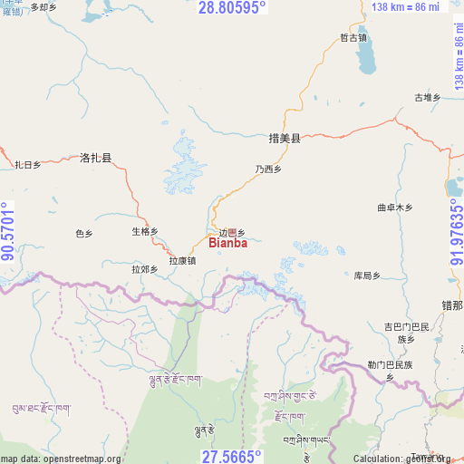
Bianba GPS coordinates[2]
28° 11' 16.872" North, 91° 16' 23.592" East
| Map corner | latitude | longitude |
|---|---|---|
| Upper-left | 28.80595°, | 90.5701° |
| Center: | 28.18802°, | 91.27322° |
| Lower-right: | 27.5665°, | 91.97635° |
| Map W x H: | 137.8×137.8 km | = 85.6×85.6mi |
| max Lat: | 53.31946° ⇑72.6% North |
| Bianba: | 28.18802° |
| min Lat: | ⇓27.4% South 18.22056° |
| min Long | Bianba | max Long |
| 75.07348° | 91.27322° | 134.28917° |
| W 3.1%⇐ | ⇒96.9% E |
Elevation
Elevation of Bianba is 3707 m = 12162 ft, and this is 3222.2 m = 10572 ft above average elevation for this country.
| Max E: |
5622 m = 18445 ft | 1.9% |
| Bianba | 3707 m 12162 ft | |
| Avg. | 484.8 m = 1591 ft | |
Min E: |
-3 m = -10 ft | 98.1% |
See also: China elevation on elevation.city.
Geographical zone
Bianba is located in North temperate zone (between Tropic of Cancer and the Arctic Circle). Distance of this Northern Tropic circle is 528.3 km =328.3 mi to South.| Distance of | km | miles | from Bianba |
|---|---|---|---|
| North Pole | 6872.8 | 4270.6 | to North |
| Arctic Circle | 4267 | 2651.4 | to North |
| Tropic Cancer | 528.3 | 328.3 | to South |
| Equator | 3134.2 | 1947.5 | to South |


Nearby cities:
15 places around Bianba: (largest is in red/bold)
• Changzhug
121.9 km =75.7 mi,  23°
23°
• Chaqi
119 km =73.9 mi,  6°
6°
• Dagar
140.2 km =87.1 mi,  335°
335°
• Dongla
111.2 km =69.1 mi,  332°
332°
• Dopozhang
131.7 km =81.8 mi, 17°
• Gongbuxue
78 km =48.5 mi, 340°
• Karlung
121.6 km =75.6 mi,  320°
320°
• Konggar
126.1 km =78.4 mi,  347°
347°
• Layu
113.1 km =70.3 mi, 19°
• Naidong
127 km =78.9 mi, 22°
• Pozhang
116.6 km =72.5 mi,  27°
27°
• Pumaqangtang
114.6 km =71.2 mi,  293°
293°
• Quchomo
48.8 km =30.3 mi,  81°
81°
• Ralung
139.1 km =86.4 mi,  300°
300°
• Xoixar
69.5 km =43.2 mi,  117°
117°
Sources, notices
• [Note1] Compared only with cities in China existing in our database
• [Src1] Map data: © OpenStreetMap contributors (CC-BY-SA)
• [Src2] Other city data from geonames.org with taken over terms of usage.
• [Src3] Geographical zone / Annual Mean Temperature by Robert A. Rohde @ Wikipedia
