Goqung geodata
Goqung (Tibet) is a seat of a fourth-order administrative division; located in China in Asia/Shanghai (GMT+8) time zone. In our database, there are 1268 cities with bigger population. Compared to other cities in China, 53.4% of cities are located further ↓South; 96.5% of cities are located further →East and 99.5% of cities have lower elevation than Goqung. Note1


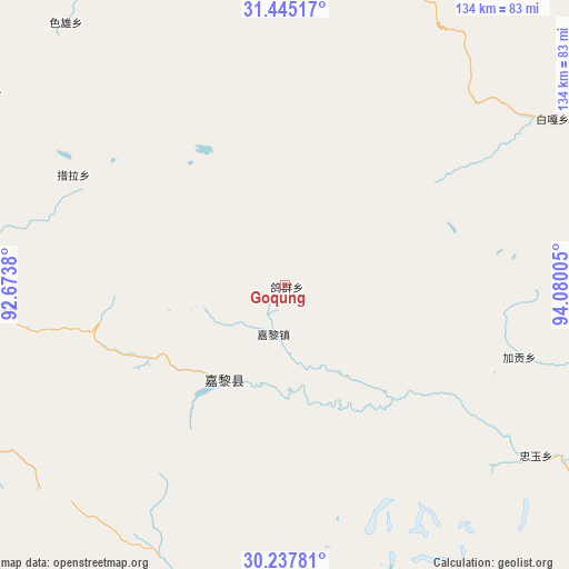
Goqung GPS coordinates[2]
30° 50' 36.204" North, 93° 22' 36.912" East
| Map corner | latitude | longitude |
|---|---|---|
| Upper-left | 31.44517°, | 92.6738° |
| Center: | 30.84339°, | 93.37692° |
| Lower-right: | 30.23781°, | 94.08005° |
| Map W x H: | 134.2×134.2 km | = 83.4×83.4mi |
| max Lat: | 53.31946° ⇑46.6% North |
| Goqung: | 30.84339° |
| min Lat: | ⇓53.4% South 18.22056° |
| min Long | Goqung | max Long |
| 75.07348° | 93.37692° | 134.28917° |
| W 3.5%⇐ | ⇒96.5% E |
Elevation
Elevation of Goqung is 4424 m = 14514 ft, and this is 3939.2 m = 12924 ft above average elevation for this country.
| Max E: |
5622 m = 18445 ft | 0.5% |
| Goqung | 4424 m 14514 ft | |
| Avg. | 484.8 m = 1591 ft | |
Min E: |
-3 m = -10 ft | 99.5% |
See also: China elevation on elevation.city.
Geographical zone
Goqung is located in North temperate zone (between Tropic of Cancer and the Arctic Circle). Distance of this Northern Tropic circle is 823.5 km =511.7 mi to South.| Distance of | km | miles | from Goqung |
|---|---|---|---|
| North Pole | 6577.6 | 4087.1 | to North |
| Arctic Circle | 3971.7 | 2467.9 | to North |
| Tropic Cancer | 823.5 | 511.7 | to South |
| Equator | 3429.5 | 2131 | to South |


Nearby cities:
15 places around Goqung: (largest is in red/bold)
• Arza
25.5 km =15.8 mi,  210°
210°
• Biru
76.7 km =47.7 mi,  21°
21°
• Biruxong
65.6 km =40.8 mi, 18°
• Caqu
76.4 km =47.5 mi,  353°
353°
• Cola
55.9 km =34.7 mi,  298°
298°
• Jaggong
57.5 km =35.7 mi,  106°
106°
• Lainqu
76.7 km =47.7 mi,  9°
9°
• Lhari
11.7 km =7.3 mi,  198°
198°
• Lingti
77.5 km =48.2 mi,  279°
279°
• Paingar
74.1 km =46 mi,  57°
57°
• Sexiong
80.7 km =50.1 mi,  320°
320°
• Xamqu
81.3 km =50.5 mi,  28°
28°
• Xarma
66.6 km =41.4 mi,  265°
265°
• Yangxoi
69.5 km =43.2 mi,  54°
54°
• Zhongyu
71.8 km =44.6 mi,  123°
123°
Sources, notices
• [Note1] Compared only with cities in China existing in our database
• [Src1] Map data: © OpenStreetMap contributors (CC-BY-SA)
• [Src2] Other city data from geonames.org with taken over terms of usage.
• [Src3] Geographical zone / Annual Mean Temperature by Robert A. Rohde @ Wikipedia
