Lhari geodata
Lhari (Tibet) is a seat of a fourth-order administrative division; located in China in Asia/Shanghai (GMT+8) time zone. In our database, there are 1268 cities with bigger population. Compared to other cities in China, 52.5% of cities are located further ↓South; 96.5% of cities are located further →East and 99.3% of cities have lower elevation than Lhari. Note1


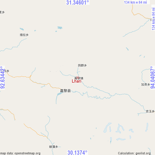
Lhari GPS coordinates[2]
30° 44' 36.96" North, 93° 20' 15.144" East
| Map corner | latitude | longitude |
|---|---|---|
| Upper-left | 31.34601°, | 92.63442° |
| Center: | 30.7436°, | 93.33754° |
| Lower-right: | 30.1374°, | 94.04067° |
| Map W x H: | 134.4×134.4 km | = 83.5×83.5mi |
| max Lat: | 53.31946° ⇑47.5% North |
| Lhari: | 30.7436° |
| min Lat: | ⇓52.5% South 18.22056° |
| min Long | Lhari | max Long |
| 75.07348° | 93.33754° | 134.28917° |
| W 3.5%⇐ | ⇒96.5% E |
Elevation
Elevation of Lhari is 4328 m = 14199 ft, and this is 3843.2 m = 12609 ft above average elevation for this country.
| Max E: |
5622 m = 18445 ft | 0.7% |
| Lhari | 4328 m 14199 ft | |
| Avg. | 484.8 m = 1591 ft | |
Min E: |
-3 m = -10 ft | 99.3% |
See also: China elevation on elevation.city.
Geographical zone
Lhari is located in North temperate zone (between Tropic of Cancer and the Arctic Circle). Distance of this Northern Tropic circle is 812.4 km =504.8 mi to South.| Distance of | km | miles | from Lhari |
|---|---|---|---|
| North Pole | 6588.7 | 4094 | to North |
| Arctic Circle | 3982.8 | 2474.8 | to North |
| Tropic Cancer | 812.4 | 504.8 | to South |
| Equator | 3418.4 | 2124.1 | to South |


Nearby cities:
15 places around Lhari: (largest is in red/bold)
• Arza
14.2 km =8.8 mi,  219°
219°
• Biru
88.4 km =54.9 mi,  21°
21°
• Biruxong
77.3 km =48 mi, 18°
• Caqu
87.1 km =54.1 mi,  356°
356°
• Cola
59 km =36.7 mi,  309°
309°
• Goqung
11.7 km =7.3 mi, 18°
• Jaggong
59.1 km =36.7 mi,  95°
95°
• Lainqu
88.3 km =54.9 mi,  11°
11°
• Lingti
76.6 km =47.6 mi,  288°
288°
• Lomai
87.8 km =54.6 mi, 310°
• Paingar
83.5 km =51.9 mi,  52°
52°
• Sexiong
87.4 km =54.3 mi,  326°
326°
• Xarma
63 km =39.1 mi,  275°
275°
• Yangxoi
79.4 km =49.3 mi, 49°
• Zhongyu
69.9 km =43.4 mi,  113°
113°
Sources, notices
• [Note1] Compared only with cities in China existing in our database
• [Src1] Map data: © OpenStreetMap contributors (CC-BY-SA)
• [Src2] Other city data from geonames.org with taken over terms of usage.
• [Src3] Geographical zone / Annual Mean Temperature by Robert A. Rohde @ Wikipedia
