Karmar geodata
Karmar (Qinghai) is a seat of a fourth-order administrative division; located in China in Asia/Shanghai (GMT+8) time zone. In our database, there are 1268 cities with bigger population. Compared to other cities in China, 79.9% of cities are located further ↓South; 95.2% of cities are located further →East and 97.8% of cities have lower elevation than Karmar. Note1


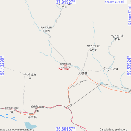
Karmar GPS coordinates[2]
37° 21' 45" North, 98° 50' 9.996" East
| Map corner | latitude | longitude |
|---|---|---|
| Upper-left | 37.91927°, | 98.13299° |
| Center: | 37.3625°, | 98.83611° |
| Lower-right: | 36.80157°, | 99.53924° |
| Map W x H: | 124.3×124.3 km | = 77.2×77.2mi |
| max Lat: | 53.31946° ⇑20.1% North |
| Karmar: | 37.3625° |
| min Lat: | ⇓79.9% South 18.22056° |
| min Long | Karmar | max Long |
| 75.07348° | 98.83611° | 134.28917° |
| W 4.8%⇐ | ⇒95.2% E |
Elevation
Elevation of Karmar is 3480 m = 11417 ft, and this is 2995.2 m = 9827 ft above average elevation for this country.
| Max E: |
5622 m = 18445 ft | 2.2% |
| Karmar | 3480 m 11417 ft | |
| Avg. | 484.8 m = 1591 ft | |
Min E: |
-3 m = -10 ft | 97.8% |
See also: China elevation on elevation.city.
Geographical zone
Karmar is located in North temperate zone (between Tropic of Cancer and the Arctic Circle). Distance of this Northern Tropic circle is 1548.4 km =962.1 mi to South.| Distance of | km | miles | from Karmar |
|---|---|---|---|
| North Pole | 5852.7 | 3636.7 | to North |
| Arctic Circle | 3246.9 | 2017.5 | to North |
| Tropic Cancer | 1548.4 | 962.1 | to South |
| Equator | 4154.3 | 2581.4 | to South |


Nearby cities:
15 places around Karmar: (largest is in red/bold)
• Chaka
66.8 km =41.5 mi,  161°
161°
• Heimahe
109.2 km =67.9 mi,  130°
130°
• Jirmeng
69 km =42.9 mi,  109°
109°
• Longmen
57.8 km =35.9 mi,  7°
7°
• Muri
88.1 km =54.7 mi, 13°
• Qiecha
78.9 km =49 mi,  121°
121°
• Serh
61.5 km =38.2 mi,  221°
221°
• Shaliuhe
114.8 km =71.3 mi,  92°
92°
• Shinaihai
82 km =51 mi, 121°
• Tongpu
51.6 km =32.1 mi, 215°
• Xinyuan
16.1 km =10 mi, 115°
• Xireg
60.3 km =37.5 mi, 215°
• Xuji
88.7 km =55.1 mi,  269°
269°
• Yangkang
36.5 km =22.7 mi,  347°
347°
• Zhugkyung
57.3 km =35.6 mi,  62°
62°
Sources, notices
• [Note1] Compared only with cities in China existing in our database
• [Src1] Map data: © OpenStreetMap contributors (CC-BY-SA)
• [Src2] Other city data from geonames.org with taken over terms of usage.
• [Src3] Geographical zone / Annual Mean Temperature by Robert A. Rohde @ Wikipedia
