Yingkeng geodata
Yingkeng (Zhejiang) is a seat of a fourth-order administrative division; located in China in Asia/Shanghai (GMT+8) time zone. In our database, there are 1268 cities with bigger population. Compared to other cities in China, 70.7% of cities are located further ↑North; 85.1% of cities are located further ←West and 64% of cities have lower elevation than Yingkeng. Note1


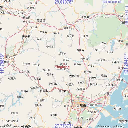
Yingkeng GPS coordinates[2]
28° 23' 38.616" North, 120° 30' 6.048" East
| Map corner | latitude | longitude |
|---|---|---|
| Upper-left | 29.01078°, | 119.79856° |
| Center: | 28.39406°, | 120.50168° |
| Lower-right: | 27.77373°, | 121.20481° |
| Map W x H: | 137.5×137.5 km | = 85.4×85.4mi |
| max Lat: | 53.31946° ⇑70.7% North |
| Yingkeng: | 28.39406° |
| min Lat: | ⇓29.3% South 18.22056° |
| min Long | Yingkeng | max Long |
| 75.07348° | 120.50168° | 134.28917° |
| W 85.1%⇐ | ⇒14.9% E |
Elevation
Elevation of Yingkeng is 310 m = 1017 ft, and this is 174.8 m = 573 ft below average elevation for this country.
| Max E: |
5622 m = 18445 ft | 36% |
| Avg. | 484.8 m = 1591 ft | |
| Yingkeng | 310 m = 1017 ft | |
Min E: |
-3 m = -10 ft | 64% |
See also: China elevation on elevation.city.
Geographical zone
Yingkeng is located in North temperate zone (between Tropic of Cancer and the Arctic Circle). Distance of this Northern Tropic circle is 551.2 km =342.5 mi to South.| Distance of | km | miles | from Yingkeng |
|---|---|---|---|
| North Pole | 6849.9 | 4256.3 | to North |
| Arctic Circle | 4244.1 | 2637.2 | to North |
| Tropic Cancer | 551.2 | 342.5 | to South |
| Equator | 3157.1 | 1961.7 | to South |


Nearby cities:
15 places around Yingkeng: (largest is in red/bold)
• Biaoshan
14.7 km =9.1 mi,  89°
89°
• Bilian
10.4 km =6.5 mi,  149°
149°
• Daruoyan
16.5 km =10.3 mi,  138°
138°
• Da’ao
5.8 km =3.6 mi,  29°
29°
• Huangyang
18.3 km =11.4 mi,  233°
233°
• Jiekeng
11.2 km =7 mi,  301°
301°
• Kunyang
16.9 km =10.5 mi,  158°
158°
• Ming’ao
12.6 km =7.8 mi,  170°
170°
• Muli
16.9 km =10.5 mi,  291°
291°
• Pankeng
10.5 km =6.5 mi,  51°
51°
• Shankeng
5.3 km =3.3 mi, 163°
• Shiran
10.3 km =6.4 mi,  242°
242°
• Xixia
11.8 km =7.3 mi,  352°
352°
• Xi’ao
11.2 km =7 mi, 286°
• Xunzhai
5.5 km =3.4 mi,  201°
201°
Sources, notices
• [Note1] Compared only with cities in China existing in our database
• [Src1] Map data: © OpenStreetMap contributors (CC-BY-SA)
• [Src2] Other city data from geonames.org with taken over terms of usage.
• [Src3] Geographical zone / Annual Mean Temperature by Robert A. Rohde @ Wikipedia
