Shanwo geodata
Shanwo (Chongqing) is a seat of a fourth-order administrative division; located in China in Asia/Shanghai (GMT+8) time zone. In our database, there are 1268 cities with bigger population. Compared to other cities in China, 58.4% of cities are located further ↑North; 82% of cities are located further →East and 67.7% of cities have lower elevation than Shanwo. Note1


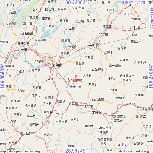
Shanwo GPS coordinates[2]
29° 36' 38.124" North, 107° 34' 3.036" East
| Map corner | latitude | longitude |
|---|---|---|
| Upper-left | 30.22003°, | 106.86439° |
| Center: | 29.61059°, | 107.56751° |
| Lower-right: | 28.99745°, | 108.27064° |
| Map W x H: | 135.9×135.9 km | = 84.4×84.4mi |
| max Lat: | 53.31946° ⇑58.4% North |
| Shanwo: | 29.61059° |
| min Lat: | ⇓41.6% South 18.22056° |
| min Long | Shanwo | max Long |
| 75.07348° | 107.56751° | 134.28917° |
| W 18%⇐ | ⇒82% E |
Elevation
Elevation of Shanwo is 371 m = 1217 ft, and this is 113.8 m = 373 ft below average elevation for this country.
| Max E: |
5622 m = 18445 ft | 32.3% |
| Avg. | 484.8 m = 1591 ft | |
| Shanwo | 371 m = 1217 ft | |
Min E: |
-3 m = -10 ft | 67.7% |
See also: China elevation on elevation.city.
Geographical zone
Shanwo is located in North temperate zone (between Tropic of Cancer and the Arctic Circle). Distance of this Northern Tropic circle is 686.5 km =426.6 mi to South.| Distance of | km | miles | from Shanwo |
|---|---|---|---|
| North Pole | 6714.7 | 4172.3 | to North |
| Arctic Circle | 4108.8 | 2553.1 | to North |
| Tropic Cancer | 686.5 | 426.6 | to South |
| Equator | 3292.4 | 2045.8 | to South |


Nearby cities:
15 places around Shanwo: (largest is in red/bold)
• Baima
23.2 km =14.4 mi,  187°
187°
• Baitao
10.2 km =6.3 mi,  229°
229°
• Baoluan
20.2 km =12.6 mi,  32°
32°
• Damu
9.3 km =5.8 mi,  84°
84°
• Fuling
19.7 km =12.2 mi,  302°
302°
• Jiaoshi
12.1 km =7.5 mi,  13°
13°
• Jiudian
22.3 km =13.9 mi,  279°
279°
• Lizhi
19.6 km =12.2 mi, 301°
• Luoyun
19.1 km =11.9 mi, 8°
• Qingxi
23.4 km =14.5 mi,  333°
333°
• Sanba
19.7 km =12.2 mi,  69°
69°
• Shuanghe
16.1 km =10 mi,  115°
115°
• Tiantai
11.8 km =7.3 mi,  294°
294°
• Wulongshan
9 km =5.6 mi,  184°
184°
• Zili
19.6 km =12.2 mi,  255°
255°
Sources, notices
• [Note1] Compared only with cities in China existing in our database
• [Src1] Map data: © OpenStreetMap contributors (CC-BY-SA)
• [Src2] Other city data from geonames.org with taken over terms of usage.
• [Src3] Geographical zone / Annual Mean Temperature by Robert A. Rohde @ Wikipedia
