Cuozheqiangma geodata
Cuozheqiangma (Hebei) is a seat of a fourth-order administrative division; located in China in Asia/Urumqi (GMT+6) time zone. In our database, there are 1268 cities with bigger population. Compared to other cities in China, 67.4% of cities are located further ↓South; 97.9% of cities are located further →East and 100% of cities have lower elevation than Cuozheqiangma. Note1


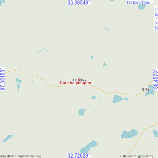
Cuozheqiangma GPS coordinates[2]
33° 18' 35.532" North, 87° 45' 16.812" East
| Map corner | latitude | longitude |
|---|---|---|
| Upper-left | 33.89549°, | 87.05155° |
| Center: | 33.30987°, | 87.75467° |
| Lower-right: | 32.72029°, | 88.4578° |
| Map W x H: | 130.7×130.7 km | = 81.2×81.2mi |
| max Lat: | 53.31946° ⇑32.6% North |
| Cuozheqiangma: | 33.30987° |
| min Lat: | ⇓67.4% South 18.22056° |
| min Long | Cuozheqiangma | max Long |
| 75.07348° | 87.75467° | 134.28917° |
| W 2.1%⇐ | ⇒97.9% E |
Elevation
Elevation of Cuozheqiangma is 5079 m = 16663 ft, and this is 4594.2 m = 15073 ft above average elevation for this country.
| Max E: |
5622 m = 18445 ft | 0% |
| Cuozheqiangma | 5079 m 16663 ft | |
| Avg. | 484.8 m = 1591 ft | |
Min E: |
-3 m = -10 ft | 100% |
See also: China elevation on elevation.city.
Geographical zone
Cuozheqiangma is located in North temperate zone (between Tropic of Cancer and the Arctic Circle). Distance of this Northern Tropic circle is 1097.8 km =682.1 mi to South.| Distance of | km | miles | from Cuozheqiangma |
|---|---|---|---|
| North Pole | 6303.4 | 3916.7 | to North |
| Arctic Circle | 3697.5 | 2297.5 | to North |
| Tropic Cancer | 1097.8 | 682.1 | to South |
| Equator | 3703.7 | 2301.4 | to South |


Nearby cities:
15 places around Cuozheqiangma: (largest is in red/bold)
• Baoji
344.2 km =213.9 mi,  138°
138°
• Beila
358.3 km =222.6 mi,  126°
126°
• Jiajuedibu
276.9 km =172.1 mi,  162°
162°
• Jiaqiong
322.2 km =200.2 mi,  124°
124°
• Luring
351.9 km =218.7 mi,  250°
250°
• Maiba
285.3 km =177.3 mi,  153°
153°
• Maindong
310.7 km =193.1 mi,  224°
224°
• Maintang
282.5 km =175.5 mi, 138°
• Maqian
293.2 km =182.2 mi, 128°
• Pubu
300.2 km =186.5 mi, 135°
• Qiangma
325.1 km =202 mi, 117°
• Qinglung
363.3 km =225.7 mi, 131°
• Tarma
318.9 km =198.2 mi, 156°
• Xinji
359.7 km =223.5 mi, 146°
• Xungmai
248.9 km =154.7 mi, 151°
Sources, notices
• [Note1] Compared only with cities in China existing in our database
• [Src1] Map data: © OpenStreetMap contributors (CC-BY-SA)
• [Src2] Other city data from geonames.org with taken over terms of usage.
• [Src3] Geographical zone / Annual Mean Temperature by Robert A. Rohde @ Wikipedia
