Maindong geodata
Maindong (Tibet) is a seat of a third-order administrative division; located in China in Asia/Shanghai (GMT+8) time zone. In our database, there are 1268 cities with bigger population. Compared to other cities in China, 57.3% of cities are located further ↓South; 98.5% of cities are located further →East and 99.9% of cities have lower elevation than Maindong. Note1


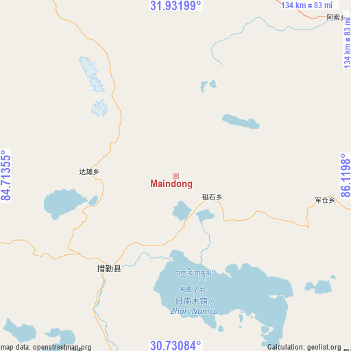
Maindong GPS coordinates[2]
31° 19' 59.988" North, 85° 25' 0.012" East
| Map corner | latitude | longitude |
|---|---|---|
| Upper-left | 31.93199°, | 84.71355° |
| Center: | 31.33333°, | 85.41667° |
| Lower-right: | 30.73084°, | 86.1198° |
| Map W x H: | 133.6×133.6 km | = 83×83mi |
| max Lat: | 53.31946° ⇑42.7% North |
| Maindong: | 31.33333° |
| min Lat: | ⇓57.3% South 18.22056° |
| min Long | Maindong | max Long |
| 75.07348° | 85.41667° | 134.28917° |
| W 1.5%⇐ | ⇒98.5% E |
Elevation
Elevation of Maindong is 4899 m = 16073 ft, and this is 4414.2 m = 14482 ft above average elevation for this country.
| Max E: |
5622 m = 18445 ft | 0.099999999999994% |
| Maindong | 4899 m 16073 ft | |
| Avg. | 484.8 m = 1591 ft | |
Min E: |
-3 m = -10 ft | 99.9% |
See also: China elevation on elevation.city.
Geographical zone
Maindong is located in North temperate zone (between Tropic of Cancer and the Arctic Circle). Distance of this Northern Tropic circle is 878 km =545.6 mi to South.| Distance of | km | miles | from Maindong |
|---|---|---|---|
| North Pole | 6523.1 | 4053.3 | to North |
| Arctic Circle | 3917.2 | 2434 | to North |
| Tropic Cancer | 878 | 545.6 | to South |
| Equator | 3483.9 | 2164.8 | to South |


Nearby cities:
15 places around Maindong: (largest is in red/bold)
• Chongdui
357.9 km =222.4 mi,  171°
171°
• Cuozheqiangma
310.7 km =193.1 mi,  44°
44°
• Jiajuedibu
309.3 km =192.2 mi,  98°
98°
• Jiding
348.9 km =216.8 mi,  128°
128°
• Luring
154.9 km =96.3 mi,  312°
312°
• Maiba
351.9 km =218.7 mi, 95°
• Ngamring
287.7 km =178.8 mi,  144°
144°
• Quxar
328.2 km =203.9 mi, 139°
• Saga
224.2 km =139.3 mi,  184°
184°
• Xagmakajor
293.2 km =182.2 mi,  273°
273°
• Xungmai
341.7 km =212.3 mi,  89°
89°
• Xêgar
340.4 km =211.5 mi,  151°
151°
• Zhabu
280.9 km =174.5 mi, 314°
• Zhadong
222.2 km =138.1 mi,  212°
212°
• Zongga
259.9 km =161.5 mi, 183°
Sources, notices
• [Note1] Compared only with cities in China existing in our database
• [Src1] Map data: © OpenStreetMap contributors (CC-BY-SA)
• [Src2] Other city data from geonames.org with taken over terms of usage.
• [Src3] Geographical zone / Annual Mean Temperature by Robert A. Rohde @ Wikipedia
