Jibenggang geodata
Jibenggang (Tibet) is a seat of a third-order administrative division; located in China in Asia/Shanghai (GMT+8) time zone. In our database, there are 1268 cities with bigger population. Compared to other cities in China, 57.9% of cities are located further ↑North; 96.9% of cities are located further →East and 98% of cities have lower elevation than Jibenggang. Note1


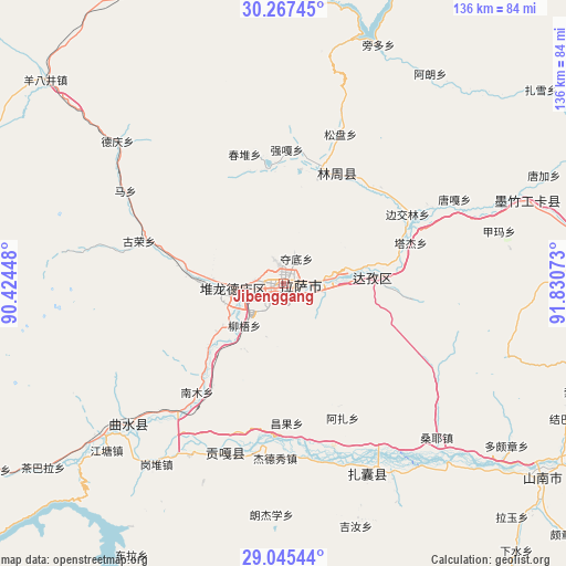
Jibenggang GPS coordinates[2]
29° 39' 29.88" North, 91° 7' 39.36" East
| Map corner | latitude | longitude |
|---|---|---|
| Upper-left | 30.26745°, | 90.42448° |
| Center: | 29.6583°, | 91.1276° |
| Lower-right: | 29.04544°, | 91.83073° |
| Map W x H: | 135.9×135.9 km | = 84.4×84.4mi |
| max Lat: | 53.31946° ⇑57.9% North |
| Jibenggang: | 29.6583° |
| min Lat: | ⇓42.1% South 18.22056° |
| min Long | Jibenggang | max Long |
| 75.07348° | 91.1276° | 134.28917° |
| W 3.1%⇐ | ⇒96.9% E |
Elevation
Elevation of Jibenggang is 3654 m = 11988 ft, and this is 3169.2 m = 10398 ft above average elevation for this country.
| Max E: |
5622 m = 18445 ft | 2% |
| Jibenggang | 3654 m 11988 ft | |
| Avg. | 484.8 m = 1591 ft | |
Min E: |
-3 m = -10 ft | 98% |
See also: China elevation on elevation.city.
Geographical zone
Jibenggang is located in North temperate zone (between Tropic of Cancer and the Arctic Circle). Distance of this Northern Tropic circle is 691.8 km =429.9 mi to South.| Distance of | km | miles | from Jibenggang |
|---|---|---|---|
| North Pole | 6709.4 | 4169 | to North |
| Arctic Circle | 4103.5 | 2549.8 | to North |
| Tropic Cancer | 691.8 | 429.9 | to South |
| Equator | 3297.7 | 2049.1 | to South |


Nearby cities:
15 places around Jibenggang: (largest is in red/bold)
• Caina
29.5 km =18.3 mi,  214°
214°
• Changzhug
81 km =50.3 mi,  129°
129°
• Chaqi
52.4 km =32.6 mi,  149°
149°
• Dagar
56 km =34.8 mi,  230°
230°
• Dongla
74.7 km =46.4 mi, 209°
• Dopozhang
66 km =41 mi, 125°
• Dêqên
51.9 km =32.2 mi,  310°
310°
• Konggar
42.7 km =26.5 mi,  198°
198°
• Layu
76.7 km =47.7 mi,  137°
137°
• Lhasa
2.8 km =1.7 mi,  250°
250°
• Naidong
77.7 km =48.3 mi, 126°
• Nam
28.5 km =17.7 mi,  222°
222°
• Niu
13.7 km =8.5 mi, 223°
• Sozhug
76.7 km =47.7 mi,  109°
109°
• Xumai
86.1 km =53.5 mi,  255°
255°
Sources, notices
• [Note1] Compared only with cities in China existing in our database
• [Src1] Map data: © OpenStreetMap contributors (CC-BY-SA)
• [Src2] Other city data from geonames.org with taken over terms of usage.
• [Src3] Geographical zone / Annual Mean Temperature by Robert A. Rohde @ Wikipedia
