Xiao Surmang geodata
Xiao Surmang (Qinghai) is a seat of a fourth-order administrative division; located in China in Asia/Shanghai (GMT+8) time zone. In our database, there are 1268 cities with bigger population. Compared to other cities in China, 63.3% of cities are located further ↓South; 95.6% of cities are located further →East and 99.3% of cities have lower elevation than Xiao Surmang. Note1


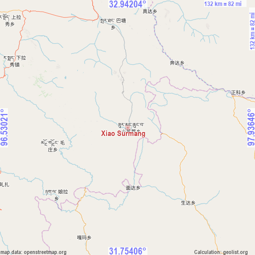
Xiao Surmang GPS coordinates[2]
32° 21' 0" North, 97° 13' 59.988" East
| Map corner | latitude | longitude |
|---|---|---|
| Upper-left | 32.94204°, | 96.53021° |
| Center: | 32.35°, | 97.23333° |
| Lower-right: | 31.75406°, | 97.93646° |
| Map W x H: | 132.1×132.1 km | = 82.1×82.1mi |
| max Lat: | 53.31946° ⇑36.7% North |
| Xiao Surmang: | 32.35° |
| min Lat: | ⇓63.3% South 18.22056° |
| min Long | Xiao Surmang | max Long |
| 75.07348° | 97.23333° | 134.28917° |
| W 4.4%⇐ | ⇒95.6% E |
Elevation
Elevation of Xiao Surmang is 4296 m = 14094 ft, and this is 3811.2 m = 12504 ft above average elevation for this country.
| Max E: |
5622 m = 18445 ft | 0.7% |
| Xiao Surmang | 4296 m 14094 ft | |
| Avg. | 484.8 m = 1591 ft | |
Min E: |
-3 m = -10 ft | 99.3% |
See also: China elevation on elevation.city.
Geographical zone
Xiao Surmang is located in North temperate zone (between Tropic of Cancer and the Arctic Circle). Distance of this Northern Tropic circle is 991.1 km =615.8 mi to South.| Distance of | km | miles | from Xiao Surmang |
|---|---|---|---|
| North Pole | 6410.1 | 3983.1 | to North |
| Arctic Circle | 3804.2 | 2363.8 | to North |
| Tropic Cancer | 991.1 | 615.8 | to South |
| Equator | 3597 | 2235.1 | to South |


Nearby cities:
15 places around Xiao Surmang: (largest is in red/bold)
• Baitang
53.2 km =33.1 mi,  352°
352°
• Gyobrag
104 km =64.6 mi,  283°
283°
• Jinisai
120 km =74.6 mi,  254°
254°
• Jiqu
114.1 km =70.9 mi, 247°
• Lab
102.8 km =63.9 mi,  355°
355°
• Mozhong
39.8 km =24.7 mi,  257°
257°
• Nyagla
50.4 km =31.3 mi,  227°
227°
• Qiezha
74.2 km =46.1 mi, 245°
• Qümong
106.9 km =66.4 mi,  49°
49°
• Racaka
125.4 km =77.9 mi,  212°
212°
• Shanglaxiu
82.7 km =51.4 mi,  312°
312°
• Xangda
72.8 km =45.2 mi, 257°
• Xialaxiu
68.2 km =42.4 mi,  301°
301°
• Xiwu
87.4 km =54.3 mi,  6°
6°
• Zhoinda
96.4 km =59.9 mi, 348°
Sources, notices
• [Note1] Compared only with cities in China existing in our database
• [Src1] Map data: © OpenStreetMap contributors (CC-BY-SA)
• [Src2] Other city data from geonames.org with taken over terms of usage.
• [Src3] Geographical zone / Annual Mean Temperature by Robert A. Rohde @ Wikipedia
