Mozhong geodata
Mozhong (Qinghai) is a seat of a fourth-order administrative division; located in China in Asia/Shanghai (GMT+8) time zone. In our database, there are 1268 cities with bigger population. Compared to other cities in China, 62.8% of cities are located further ↓South; 95.7% of cities are located further →East and 98.1% of cities have lower elevation than Mozhong. Note1


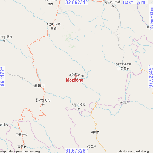
Mozhong GPS coordinates[2]
32° 16' 11.064" North, 96° 49' 13.152" East
| Map corner | latitude | longitude |
|---|---|---|
| Upper-left | 32.86231°, | 96.1172° |
| Center: | 32.26974°, | 96.82032° |
| Lower-right: | 31.67328°, | 97.52345° |
| Map W x H: | 132.2×132.2 km | = 82.1×82.1mi |
| max Lat: | 53.31946° ⇑37.2% North |
| Mozhong: | 32.26974° |
| min Lat: | ⇓62.8% South 18.22056° |
| min Long | Mozhong | max Long |
| 75.07348° | 96.82032° | 134.28917° |
| W 4.3%⇐ | ⇒95.7% E |
Elevation
Elevation of Mozhong is 3741 m = 12274 ft, and this is 3256.2 m = 10683 ft above average elevation for this country.
| Max E: |
5622 m = 18445 ft | 1.9% |
| Mozhong | 3741 m 12274 ft | |
| Avg. | 484.8 m = 1591 ft | |
Min E: |
-3 m = -10 ft | 98.1% |
See also: China elevation on elevation.city.
Geographical zone
Mozhong is located in North temperate zone (between Tropic of Cancer and the Arctic Circle). Distance of this Northern Tropic circle is 982.1 km =610.2 mi to South.| Distance of | km | miles | from Mozhong |
|---|---|---|---|
| North Pole | 6419 | 3988.6 | to North |
| Arctic Circle | 3813.1 | 2369.3 | to North |
| Tropic Cancer | 982.1 | 610.2 | to South |
| Equator | 3588.1 | 2229.5 | to South |


Nearby cities:
15 places around Mozhong: (largest is in red/bold)
• Baitang
69.2 km =43 mi,  26°
26°
• Gaxung
111.8 km =69.5 mi,  258°
258°
• Gyobrag
70.7 km =43.9 mi,  297°
297°
• Jinisai
80.2 km =49.8 mi,  253°
253°
• Jiqu
75.2 km =46.7 mi,  241°
241°
• Nyagla
25.5 km =15.8 mi,  175°
175°
• Qiezha
36 km =22.4 mi,  233°
233°
• Racaka
100.9 km =62.7 mi,  196°
196°
• Shanglaxiu
68.6 km =42.6 mi,  341°
341°
• Xangda
33 km =20.5 mi, 257°
• Xialaxiu
48.4 km =30.1 mi, 335°
• Xiao Surmang
39.8 km =24.7 mi,  77°
77°
• Xiwu
107.6 km =66.9 mi, 27°
• Zhexiao
105.8 km =65.7 mi,  285°
285°
• Zhoinda
105.3 km =65.4 mi,  10°
10°
Sources, notices
• [Note1] Compared only with cities in China existing in our database
• [Src1] Map data: © OpenStreetMap contributors (CC-BY-SA)
• [Src2] Other city data from geonames.org with taken over terms of usage.
• [Src3] Geographical zone / Annual Mean Temperature by Robert A. Rohde @ Wikipedia
