Zhoinda geodata
Zhoinda (Qinghai) is a seat of a fourth-order administrative division; located in China in Asia/Shanghai (GMT+8) time zone. In our database, there are 1268 cities with bigger population. Compared to other cities in China, 67% of cities are located further ↓South; 95.6% of cities are located further →East and 97.9% of cities have lower elevation than Zhoinda. Note1


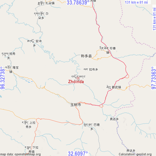
Zhoinda GPS coordinates[2]
33° 12' 0.072" North, 97° 1' 49.8" East
| Map corner | latitude | longitude |
|---|---|---|
| Upper-left | 33.78639°, | 96.32738° |
| Center: | 33.20002°, | 97.0305° |
| Lower-right: | 32.6097°, | 97.73363° |
| Map W x H: | 130.8×130.8 km | = 81.3×81.3mi |
| max Lat: | 53.31946° ⇑33% North |
| Zhoinda: | 33.20002° |
| min Lat: | ⇓67% South 18.22056° |
| min Long | Zhoinda | max Long |
| 75.07348° | 97.0305° | 134.28917° |
| W 4.4%⇐ | ⇒95.6% E |
Elevation
Elevation of Zhoinda is 3625 m = 11893 ft, and this is 3140.2 m = 10302 ft above average elevation for this country.
| Max E: |
5622 m = 18445 ft | 2.1% |
| Zhoinda | 3625 m 11893 ft | |
| Avg. | 484.8 m = 1591 ft | |
Min E: |
-3 m = -10 ft | 97.9% |
See also: China elevation on elevation.city.
Geographical zone
Zhoinda is located in North temperate zone (between Tropic of Cancer and the Arctic Circle). Distance of this Northern Tropic circle is 1085.6 km =674.6 mi to South.| Distance of | km | miles | from Zhoinda |
|---|---|---|---|
| North Pole | 6315.6 | 3924.3 | to North |
| Arctic Circle | 3709.7 | 2305.1 | to North |
| Tropic Cancer | 1085.6 | 674.6 | to South |
| Equator | 3691.5 | 2293.8 | to South |


Nearby cities:
15 places around Zhoinda: (largest is in red/bold)
• Anchong
47.3 km =29.4 mi,  308°
308°
• Bagan
90.8 km =56.4 mi,  328°
328°
• Baitang
43.4 km =27 mi,  164°
164°
• Gaduo
61.2 km =38 mi, 329°
• Gyairong
57.1 km =35.5 mi,  277°
277°
• Lab
13.1 km =8.1 mi,  52°
52°
• Linxin
100.4 km =62.4 mi,  296°
296°
• Mozhong
105.3 km =65.4 mi,  190°
190°
• Qingshuihe
67.9 km =42.2 mi,  8°
8°
• Qümong
102.5 km =63.7 mi,  103°
103°
• Shanglaxiu
56.7 km =35.2 mi,  227°
227°
• Xialaxiu
71 km =44.1 mi,  213°
213°
• Xiao Surmang
96.4 km =59.9 mi,  168°
168°
• Xiwu
30.5 km =19 mi, 104°
• Zadoi
68.8 km =42.8 mi,  337°
337°
Sources, notices
• [Note1] Compared only with cities in China existing in our database
• [Src1] Map data: © OpenStreetMap contributors (CC-BY-SA)
• [Src2] Other city data from geonames.org with taken over terms of usage.
• [Src3] Geographical zone / Annual Mean Temperature by Robert A. Rohde @ Wikipedia
