Hoxut geodata
Hoxut (Xinjiang) is a seat of a third-order administrative division; located in China in Asia/Urumqi (GMT+6) time zone. In our database, there are 1268 cities with bigger population. Compared to other cities in China, 91.2% of cities are located further ↓South; 98.2% of cities are located further →East and 86.6% of cities have lower elevation than Hoxut. Note1


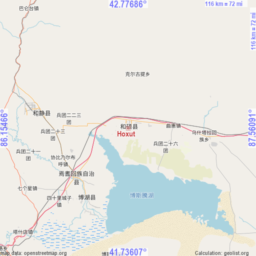
Hoxut GPS coordinates[2]
42° 15' 30.996" North, 86° 51' 28.008" East
| Map corner | latitude | longitude |
|---|---|---|
| Upper-left | 42.77686°, | 86.15466° |
| Center: | 42.25861°, | 86.85778° |
| Lower-right: | 41.73607°, | 87.56091° |
| Map W x H: | 115.7×115.7 km | = 71.9×71.9mi |
| max Lat: | 53.31946° ⇑8.8% North |
| Hoxut: | 42.25861° |
| min Lat: | ⇓91.2% South 18.22056° |
| min Long | Hoxut | max Long |
| 75.07348° | 86.85778° | 134.28917° |
| W 1.8%⇐ | ⇒98.2% E |
Elevation
Elevation of Hoxut is 1085 m = 3560 ft, and this is 600.2 m = 1969 ft above average elevation for this country.
| Max E: |
5622 m = 18445 ft | 13.4% |
| Hoxut | 1085 m 3560 ft | |
| Avg. | 484.8 m = 1591 ft | |
Min E: |
-3 m = -10 ft | 86.6% |
See also: China elevation on elevation.city.
Geographical zone
Hoxut is located in North temperate zone (between Tropic of Cancer and the Arctic Circle). Distance of this Northern Tropic circle is 2092.8 km =1300.4 mi to South.| Distance of | km | miles | from Hoxut |
|---|---|---|---|
| North Pole | 5308.3 | 3298.4 | to North |
| Arctic Circle | 2702.5 | 1679.3 | to North |
| Tropic Cancer | 2092.8 | 1300.4 | to South |
| Equator | 4698.7 | 2919.6 | to South |


Nearby cities:
15 places around Hoxut: (largest is in red/bold)
• Baluntaicun
63.2 km =39.3 mi,  316°
316°
• Beijinglu
184.7 km =114.8 mi,  18°
18°
• Bohu
36.2 km =22.5 mi,  212°
212°
• Dabancheng
170.8 km =106.1 mi,  44°
44°
• Ewirgol
102.4 km =63.6 mi, 39°
• Hejing
39.6 km =24.6 mi,  279°
279°
• Huoche Xizhan
185.1 km =115 mi,  14°
14°
• Korla
80.4 km =50 mi,  226°
226°
• Sishilichengzi
45.6 km =28.3 mi,  223°
223°
• Toksun
157.8 km =98.1 mi,  67°
67°
• Xingfulu
180.9 km =112.4 mi, 20°
• Yangzi Jianglu
178.6 km =111 mi, 19°
• Yanqi
32.5 km =20.2 mi, 227°
• Yuli
114 km =70.8 mi, 205°
• Ürümqi
181.8 km =113 mi, 19°
Sources, notices
• [Note1] Compared only with cities in China existing in our database
• [Src1] Map data: © OpenStreetMap contributors (CC-BY-SA)
• [Src2] Other city data from geonames.org with taken over terms of usage.
• [Src3] Geographical zone / Annual Mean Temperature by Robert A. Rohde @ Wikipedia
