Sanchahe geodata
Sanchahe (Guizhou) is a populated place; located in China in Asia/Shanghai (GMT+8) time zone. With population of 1,770 people, there are 1057 cities with bigger population in this country. Compared to other cities in China, 69.8% of cities are located further ↑North; 85.4% of cities are located further →East and 87.6% of cities have lower elevation than Sanchahe. Note1


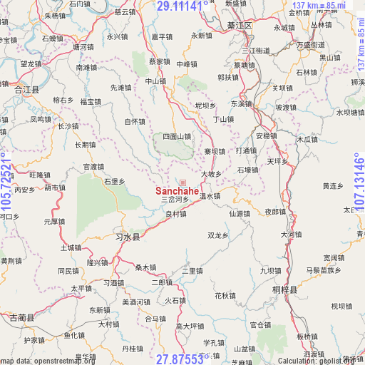
Sanchahe GPS coordinates[2]
28° 29' 43.008" North, 106° 25' 41.988" East
| Map corner | latitude | longitude |
|---|---|---|
| Upper-left | 29.11141°, | 105.72521° |
| Center: | 28.49528°, | 106.42833° |
| Lower-right: | 27.87553°, | 107.13146° |
| Map W x H: | 137.4×137.4 km | = 85.4×85.4mi |
| max Lat: | 53.31946° ⇑69.8% North |
| Sanchahe: | 28.49528° |
| min Lat: | ⇓30.2% South 18.22056° |
| min Long | Sanchahe | max Long |
| 75.07348° | 106.42833° | 134.28917° |
| W 14.6%⇐ | ⇒85.4% E |
Elevation
Elevation of Sanchahe is 1157 m = 3796 ft, and this is 672.2 m = 2205 ft above average elevation for this country.
| Max E: |
5622 m = 18445 ft | 12.4% |
| Sanchahe | 1157 m 3796 ft | |
| Avg. | 484.8 m = 1591 ft | |
Min E: |
-3 m = -10 ft | 87.6% |
See also: China elevation on elevation.city.
Geographical zone
Sanchahe is located in North temperate zone (between Tropic of Cancer and the Arctic Circle). Distance of this Northern Tropic circle is 562.5 km =349.5 mi to South.| Distance of | km | miles | from Sanchahe |
|---|---|---|---|
| North Pole | 6838.7 | 4249.4 | to North |
| Arctic Circle | 4232.8 | 2630.1 | to North |
| Tropic Cancer | 562.5 | 349.5 | to South |
| Equator | 3168.4 | 1968.8 | to South |


Nearby cities:
15 places around Sanchahe: (largest is in red/bold)
• Bailin
26.9 km =16.7 mi,  6°
6°
• Changqi
37.8 km =23.5 mi,  291°
291°
• Datong
25.9 km =16.1 mi,  64°
64°
• Donghuang
27.5 km =17.1 mi,  229°
229°
• Dongxi
37.3 km =23.2 mi,  37°
37°
• Guandian
28.6 km =17.8 mi,  141°
141°
• Guandu
32.8 km =20.4 mi,  284°
284°
• Liangcunchang
9.9 km =6.2 mi,  182°
182°
• Sangmu
34.8 km =21.6 mi,  206°
206°
• Sanyuanchang
30.6 km =19 mi,  239°
239°
• Wenshui
10.8 km =6.7 mi,  117°
117°
• Xianyuan
20.9 km =13 mi,  126°
126°
• Yelang
35.9 km =22.3 mi,  106°
106°
• Yong’an
32.5 km =20.2 mi, 180°
• Zhaiba
17.3 km =10.7 mi,  46°
46°
Sources, notices
• [Note1] Compared only with cities in China existing in our database
• [Src1] Map data: © OpenStreetMap contributors (CC-BY-SA)
• [Src2] Other city data from geonames.org with taken over terms of usage.
• [Src3] Geographical zone / Annual Mean Temperature by Robert A. Rohde @ Wikipedia
