Zapatoca geodata
Zapatoca (Santander) is a seat of a second-order administrative division; located in Colombia in America/Bogota (GMT-5) time zone. With population of 6,052 people, there are 448 cities with bigger population in this country. Compared to other cities in Colombia, 72.7% of cities are located further ↓South; 81.3% of cities are located further ←West and 68.5% of cities have lower elevation than Zapatoca. Note1


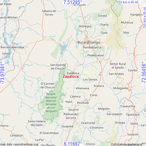
Zapatoca GPS coordinates[2]
6° 48' 55.152" North, 73° 16' 3.648" West
| Map corner | latitude | longitude |
|---|---|---|
| Upper-left | 7.51295°, | -73.97081° |
| Center: | 6.81532°, | -73.26768° |
| Lower-right: | 6.11667°, | -72.56456° |
| Map W x H: | 155.3×155.3 km | = 96.5×96.5mi |
| max Lat: | 13.38166° ⇑27.3% North |
| Zapatoca: | 6.81532° |
| min Lat: | ⇓72.7% South -4.21528° |
| min Long | Zapatoca | max Long |
| -81.70636° | -73.26768° | -67.06996° |
| W 81.3%⇐ | ⇒18.7% E |
Elevation
Elevation of Zapatoca is 1696 m = 5564 ft, and this is 546.7 m = 1794 ft above average elevation for this country.
| Max E: |
3342 m = 10965 ft | 31.5% |
| Zapatoca | 1696 m 5564 ft | |
| Avg. | 1149.3 m = 3771 ft | |
Min E: |
1 m = 3 ft | 68.5% |
See also: Colombia elevation on elevation.city.
Geographical zone
Zapatoca is located in North Torrid zone (between Equator and Tropic of Cancer). Distance of Equator is 757.8 km =470.9 mi to South.| Distance of | km | miles | from Zapatoca |
|---|---|---|---|
| North Pole | 9249.3 | 5747.2 | to North |
| Arctic Circle | 6643.4 | 4128 | to North |
| Tropic Cancer | 1848.1 | 1148.4 | to North |
| Equator | 757.8 | 470.9 | to South |


Nearby cities:
15 places around Zapatoca: (largest is in red/bold)
• Aratoca
30.6 km =19 mi,  116°
116°
• Barichara
20.6 km =12.8 mi,  166°
166°
• Betulia
9.7 km =6 mi,  349°
349°
• Cabrera
24.9 km =15.5 mi, 174°
• El Carmen de Chucurí
29.9 km =18.6 mi,  243°
243°
• Galán
19.9 km =12.4 mi,  186°
186°
• Girón
30.1 km =18.7 mi,  21°
21°
• Hato
30.6 km =19 mi, 188°
• Jordán
21.1 km =13.1 mi, 115°
• Los Santos
19.3 km =12 mi,  110°
110°
• Palmar
31 km =19.3 mi, 185°
• Piedecuesta
30.8 km =19.1 mi,  51°
51°
• San Gil
31.9 km =19.8 mi,  152°
152°
• San Vicente de Chucurí
17.3 km =10.7 mi,  294°
294°
• Villanueva
19 km =11.8 mi, 147°
Sources, notices
• [Note1] Compared only with cities in Colombia existing in our database
• [Src1] Map data: © OpenStreetMap contributors (CC-BY-SA)
• [Src2] Other city data from geonames.org with taken over terms of usage.
• [Src3] Geographical zone / Annual Mean Temperature by Robert A. Rohde @ Wikipedia
