Yacopí geodata
Yacopí (Cundinamarca) is a seat of a second-order administrative division; located in Colombia in America/Bogota (GMT-5) time zone. With population of 3,202 people, there are 664 cities with bigger population in this country. Compared to other cities in Colombia, 51.3% of cities are located further ↑North; 60% of cities are located further ←West and 54.4% of cities have lower elevation than Yacopí. Note1


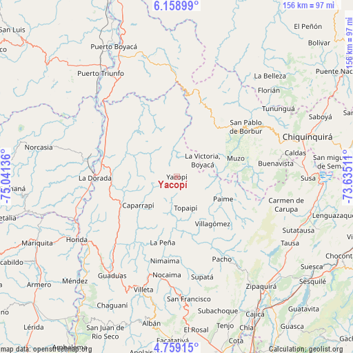
Yacopí GPS coordinates[2]
5° 27' 34.128" North, 74° 20' 17.628" West
| Map corner | latitude | longitude |
|---|---|---|
| Upper-left | 6.15899°, | -75.04136° |
| Center: | 5.45948°, | -74.33823° |
| Lower-right: | 4.75915°, | -73.63511° |
| Map W x H: | 155.6×155.7 km | = 96.7×96.7mi |
| max Lat: | 13.38166° ⇑51.3% North |
| Yacopí: | 5.45948° |
| min Lat: | ⇓48.7% South -4.21528° |
| min Long | Yacopí | max Long |
| -81.70636° | -74.33823° | -67.06996° |
| W 60%⇐ | ⇒40% E |
Elevation
Elevation of Yacopí is 1281 m = 4203 ft, and this is 131.7 m = 432 ft above average elevation for this country.
| Max E: |
3342 m = 10965 ft | 45.6% |
| Yacopí | 1281 m 4203 ft | |
| Avg. | 1149.3 m = 3771 ft | |
Min E: |
1 m = 3 ft | 54.4% |
See also: Colombia elevation on elevation.city.
Geographical zone
Yacopí is located in North Torrid zone (between Equator and Tropic of Cancer). Distance of Equator is 607 km =377.2 mi to South.| Distance of | km | miles | from Yacopí |
|---|---|---|---|
| North Pole | 9400 | 5840.9 | to North |
| Arctic Circle | 6794.1 | 4221.7 | to North |
| Tropic Cancer | 1998.9 | 1242.1 | to North |
| Equator | 607 | 377.2 | to South |


Nearby cities:
15 places around Yacopí: (largest is in red/bold)
• Cachipay
33.2 km =20.6 mi,  229°
229°
• Caparrapí
21.1 km =13.1 mi, 233°
• Coper
32.6 km =20.3 mi,  86°
86°
• El Peñón
23.6 km =14.7 mi,  167°
167°
• La Palma
12.6 km =7.8 mi,  207°
207°
• La Peña
29.7 km =18.5 mi,  191°
191°
• La Victoria
13.5 km =8.4 mi,  56°
56°
• Muzo
26.9 km =16.7 mi,  71°
71°
• Otanche
27.9 km =17.3 mi,  38°
38°
• Paime
22.8 km =14.2 mi,  115°
115°
• Quípama
19 km =11.8 mi, 69°
• San Cayetano
34.5 km =21.4 mi, 120°
• Topaipí
14.4 km =8.9 mi,  164°
164°
• Villagómez
26 km =16.2 mi,  142°
142°
• Útica
34.1 km =21.2 mi, 207°
Sources, notices
• [Note1] Compared only with cities in Colombia existing in our database
• [Src1] Map data: © OpenStreetMap contributors (CC-BY-SA)
• [Src2] Other city data from geonames.org with taken over terms of usage.
• [Src3] Geographical zone / Annual Mean Temperature by Robert A. Rohde @ Wikipedia
