La Victoria geodata
La Victoria (Boyacá) is a seat of a second-order administrative division; located in Colombia in America/Bogota (GMT-5) time zone. In our database, there are 1053 cities with bigger population. Compared to other cities in Colombia, 50% of cities are located further ↓South; 61.4% of cities are located further ←West and 59.4% of cities have lower elevation than La Victoria. Note1


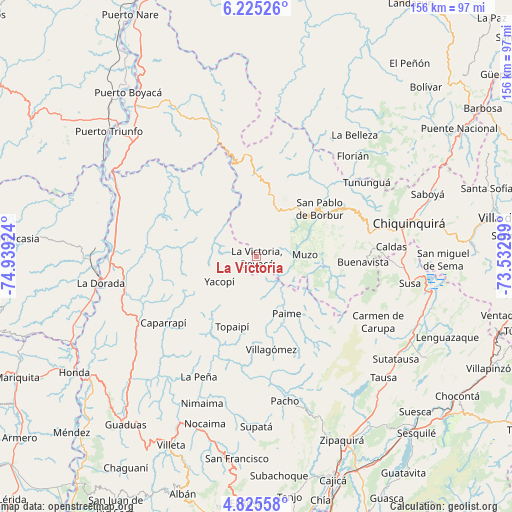
La Victoria GPS coordinates[2]
5° 31' 32.988" North, 74° 14' 9.996" West
| Map corner | latitude | longitude |
|---|---|---|
| Upper-left | 6.22526°, | -74.93924° |
| Center: | 5.52583°, | -74.23611° |
| Lower-right: | 4.82558°, | -73.53299° |
| Map W x H: | 155.6×155.6 km | = 96.7×96.7mi |
| max Lat: | 13.38166° ⇑50% North |
| La Victoria: | 5.52583° |
| min Lat: | ⇓50% South -4.21528° |
| min Long | La Victoria | max Long |
| -81.70636° | -74.23611° | -67.06996° |
| W 61.4%⇐ | ⇒38.6% E |
Elevation
Elevation of La Victoria is 1450 m = 4757 ft, and this is 300.7 m = 987 ft above average elevation for this country.
| Max E: |
3342 m = 10965 ft | 40.6% |
| La Victoria | 1450 m 4757 ft | |
| Avg. | 1149.3 m = 3771 ft | |
Min E: |
1 m = 3 ft | 59.4% |
See also: Colombia elevation on elevation.city.
Geographical zone
La Victoria is located in North Torrid zone (between Equator and Tropic of Cancer). Distance of Equator is 614.4 km =381.8 mi to South.| Distance of | km | miles | from La Victoria |
|---|---|---|---|
| North Pole | 9392.6 | 5836.3 | to North |
| Arctic Circle | 6786.8 | 4217.1 | to North |
| Tropic Cancer | 1991.5 | 1237.5 | to North |
| Equator | 614.4 | 381.8 | to South |


Nearby cities:
15 places around La Victoria: (largest is in red/bold)
• Coper
21.9 km =13.6 mi,  104°
104°
• El Peñón
31 km =19.3 mi,  191°
191°
• La Palma
25.2 km =15.7 mi,  222°
222°
• Maripí
25.3 km =15.7 mi,  83°
83°
• Muzo
14.2 km =8.8 mi,  85°
85°
• Otanche
15.7 km =9.8 mi,  22°
22°
• Paime
19.6 km =12.2 mi,  151°
151°
• Pauna
31.7 km =19.7 mi,  62°
62°
• Quípama
6.5 km =4 mi, 96°
• San Cayetano
31 km =19.3 mi,  143°
143°
• San Cayetano
31.4 km =19.5 mi,  132°
132°
• San Pablo de Borbur
23.1 km =14.4 mi,  52°
52°
• Topaipí
22.5 km =14 mi,  199°
199°
• Villagómez
28.4 km =17.6 mi,  171°
171°
• Yacopí
13.5 km =8.4 mi,  236°
236°
Sources, notices
• [Note1] Compared only with cities in Colombia existing in our database
• [Src1] Map data: © OpenStreetMap contributors (CC-BY-SA)
• [Src2] Other city data from geonames.org with taken over terms of usage.
• [Src3] Geographical zone / Annual Mean Temperature by Robert A. Rohde @ Wikipedia
