Quípama geodata
Quípama (Boyacá) is a seat of a second-order administrative division; located in Colombia in America/Bogota (GMT-5) time zone. With population of 3,571 people, there are 623 cities with bigger population in this country. Compared to other cities in Colombia, 50% of cities are located further ↓South; 62.4% of cities are located further ←West and 53.8% of cities have lower elevation than Quípama. Note1


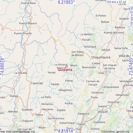
Quípama GPS coordinates[2]
5° 31' 9.84" North, 74° 10' 39.54" West
| Map corner | latitude | longitude |
|---|---|---|
| Upper-left | 6.21883°, | -74.88078° |
| Center: | 5.5194°, | -74.17765° |
| Lower-right: | 4.81914°, | -73.47453° |
| Map W x H: | 155.6×155.6 km | = 96.7×96.7mi |
| max Lat: | 13.38166° ⇑50% North |
| Quípama: | 5.5194° |
| min Lat: | ⇓50% South -4.21528° |
| min Long | Quípama | max Long |
| -81.70636° | -74.17765° | -67.06996° |
| W 62.4%⇐ | ⇒37.6% E |
Elevation
Elevation of Quípama is 1265 m = 4150 ft, and this is 115.7 m = 380 ft above average elevation for this country.
| Max E: |
3342 m = 10965 ft | 46.2% |
| Quípama | 1265 m 4150 ft | |
| Avg. | 1149.3 m = 3771 ft | |
Min E: |
1 m = 3 ft | 53.8% |
See also: Colombia elevation on elevation.city.
Geographical zone
Quípama is located in North Torrid zone (between Equator and Tropic of Cancer). Distance of Equator is 613.7 km =381.3 mi to South.| Distance of | km | miles | from Quípama |
|---|---|---|---|
| North Pole | 9393.4 | 5836.8 | to North |
| Arctic Circle | 6787.5 | 4217.6 | to North |
| Tropic Cancer | 1992.2 | 1237.9 | to North |
| Equator | 613.7 | 381.3 | to South |


Nearby cities:
15 places around Quípama: (largest is in red/bold)
• Buenavista
25.3 km =15.7 mi,  91°
91°
• Coper
15.5 km =9.6 mi,  107°
107°
• La Palma
29.5 km =18.3 mi,  232°
232°
• La Victoria
6.5 km =4 mi,  276°
276°
• Maripí
19.1 km =11.9 mi,  79°
79°
• Muzo
7.9 km =4.9 mi, 77°
• Otanche
15.3 km =9.5 mi,  357°
357°
• Paime
16.8 km =10.4 mi,  170°
170°
• Pauna
26.6 km =16.5 mi,  54°
54°
• San Cayetano
26.4 km =16.4 mi,  140°
140°
• San Cayetano
27 km =16.8 mi,  153°
153°
• San Pablo de Borbur
18.9 km =11.7 mi,  39°
39°
• Topaipí
24.8 km =15.4 mi,  214°
214°
• Villagómez
27.4 km =17 mi,  184°
184°
• Yacopí
19 km =11.8 mi,  249°
249°
Sources, notices
• [Note1] Compared only with cities in Colombia existing in our database
• [Src1] Map data: © OpenStreetMap contributors (CC-BY-SA)
• [Src2] Other city data from geonames.org with taken over terms of usage.
• [Src3] Geographical zone / Annual Mean Temperature by Robert A. Rohde @ Wikipedia
