La Palma geodata
La Palma (Cundinamarca) is a seat of a second-order administrative division; located in Colombia in America/Bogota (GMT-5) time zone. In our database, there are 1053 cities with bigger population. Compared to other cities in Colombia, 53.3% of cities are located further ↑North; 58.8% of cities are located further ←West and 59.3% of cities have lower elevation than La Palma. Note1


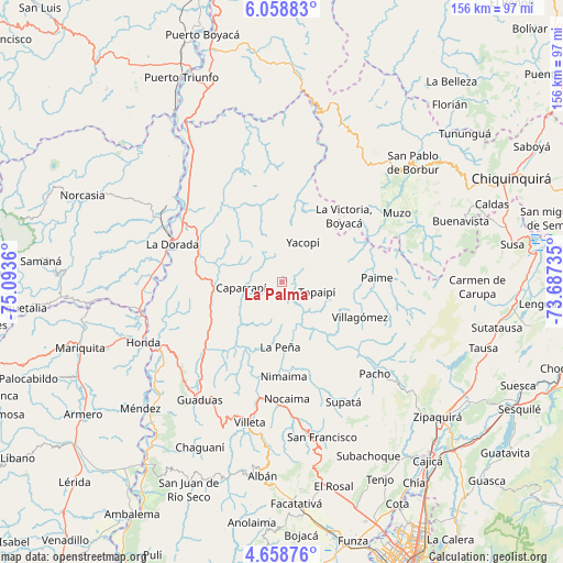
La Palma GPS coordinates[2]
5° 21' 33.12" North, 74° 23' 25.692" West
| Map corner | latitude | longitude |
|---|---|---|
| Upper-left | 6.05883°, | -75.0936° |
| Center: | 5.3592°, | -74.39047° |
| Lower-right: | 4.65876°, | -73.68735° |
| Map W x H: | 155.7×155.7 km | = 96.7×96.7mi |
| max Lat: | 13.38166° ⇑53.3% North |
| La Palma: | 5.3592° |
| min Lat: | ⇓46.7% South -4.21528° |
| min Long | La Palma | max Long |
| -81.70636° | -74.39047° | -67.06996° |
| W 58.8%⇐ | ⇒41.2% E |
Elevation
Elevation of La Palma is 1447 m = 4747 ft, and this is 297.7 m = 977 ft above average elevation for this country.
| Max E: |
3342 m = 10965 ft | 40.7% |
| La Palma | 1447 m 4747 ft | |
| Avg. | 1149.3 m = 3771 ft | |
Min E: |
1 m = 3 ft | 59.3% |
See also: Colombia elevation on elevation.city.
Geographical zone
La Palma is located in North Torrid zone (between Equator and Tropic of Cancer). Distance of Equator is 595.9 km =370.3 mi to South.| Distance of | km | miles | from La Palma |
|---|---|---|---|
| North Pole | 9411.2 | 5847.8 | to North |
| Arctic Circle | 6805.3 | 4228.6 | to North |
| Tropic Cancer | 2010 | 1249 | to North |
| Equator | 595.9 | 370.3 | to South |


Nearby cities:
15 places around La Palma: (largest is in red/bold)
• Cachipay
22.1 km =13.7 mi,  242°
242°
• Caparrapí
11.3 km =7 mi,  262°
262°
• El Peñón
16.2 km =10.1 mi,  137°
137°
• La Peña
17.9 km =11.1 mi,  181°
181°
• La Victoria
25.2 km =15.7 mi,  42°
42°
• Nimaima
25.9 km =16.1 mi, 178°
• Paime
26.4 km =16.4 mi,  87°
87°
• Puerto Salgar
31.4 km =19.5 mi,  291°
291°
• Quebradanegra
28.6 km =17.8 mi,  200°
200°
• Quípama
29.5 km =18.3 mi,  52°
52°
• Topaipí
10.1 km =6.3 mi,  105°
105°
• Vergara
27.2 km =16.9 mi,  169°
169°
• Villagómez
23.5 km =14.6 mi, 113°
• Yacopí
12.6 km =7.8 mi,  27°
27°
• Útica
21.6 km =13.4 mi,  207°
207°
Sources, notices
• [Note1] Compared only with cities in Colombia existing in our database
• [Src1] Map data: © OpenStreetMap contributors (CC-BY-SA)
• [Src2] Other city data from geonames.org with taken over terms of usage.
• [Src3] Geographical zone / Annual Mean Temperature by Robert A. Rohde @ Wikipedia
